Vit’anim
Vit’anim is a sports venue in Grenoble, Isère, Auvergne-Rhône-Alpes which is located on Rue Sidi-Brahim. Vit’anim is situated nearby to the synagogue Centre d’Études Juives, as well as near the community center Maison de la culture arménienne de Grenoble et du Dauphiné.| Tap on a place to explore it |
Places of Interest Nearby
Highlights include Grenoble Graduate School of Business and St. George’s Church, Grenoble, France.
Grenoble Graduate School of Business
College
 Grenoble Ecole de Management is a French graduate business school or Grande Ecole, founded in 1984 in Grenoble, in the Auvergne-Rhone Alpes region by the Chamber of Commerce and Industry of Grenoble. Grenoble Graduate School of Business is situated 1¼ km north of Vit’anim.
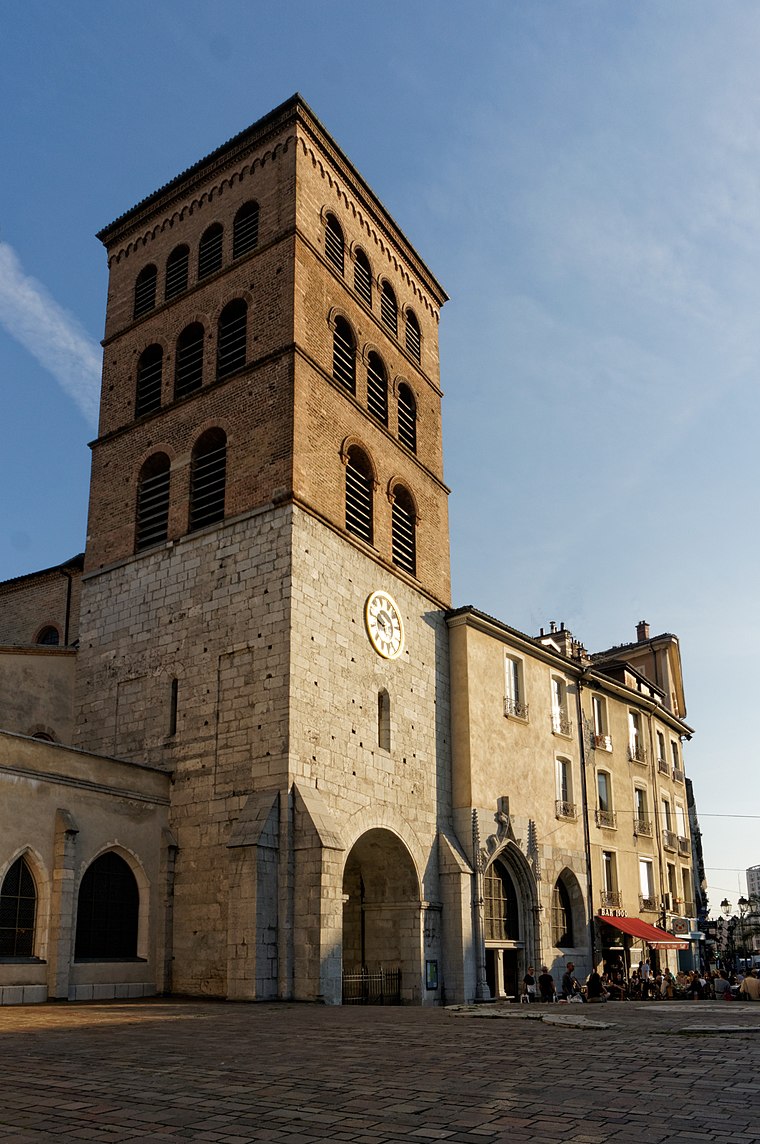
St. George’s Church, Grenoble, France
Church

Photo: Patafisik, CC BY-SA 3.0.
St. George’s Church, Grenoble, France is situated 370 metres northeast of Vit’anim.
Église Saint-Jean, Grenoble
Church
 Église Saint-Jean, Grenoble is a church, which is situated 380 metres northwest of Vit’anim.
Places in the Area
Nearby places include Notre-Dame and Seyssinet-Pariset.
Seyssinet-Pariset
Town

Photo: Milky, CC BY-SA 3.0.
Seyssinet-Pariset is a commune in the Isère department in southeastern France. It is part of the Grenoble urban unit.
Saint-Martin-d’Hères
Town

Photo: Binnette, CC BY-SA 3.0.
Saint-Martin-d'Hères is a commune in the Isère department in southeastern France. Part of the Grenoble urban unit, it is the largest suburb of the city of Grenoble and is adjacent to it on the east. Saint-Martin-d’Hères is situated 3 km east of Vit’anim.
Vit’anim
- Type: Sports venue
- Address: 7 Rue Sidi-Brahim
- Categories: recreation area and sports location
- Location: Grenoble, Arrondissement of Grenoble, Isère, Auvergne-Rhône-Alpes, France, Europe
- View on OpenStreetMap
Latitude
45.17832° or 45° 10′ 42″ northLongitude
5.71734° or 5° 43′ 2″ eastOpen location code
8FQ75PH8+8WOpenStreetMap ID
node 6165824900OpenStreetMap feature
leisure=sports_centreOpenStreetMap feature
sport=circus
This page is based on OpenStreetMap, Wikidata, and Wikimedia Commons.
We’d love your help improving our open data sources. Thank you for contributing.
Satellite Map
Discover Vit’anim from above in high-definition satellite imagery.
Notable Places Nearby
Highlights include Centre d’Études Juives and Maison de la culture arménienne de Grenoble et du Dauphiné.
Nearby Places
Explore places such as Grenoble Carrosserie and Azad Magazine.
Isère: Must-Visit Destinations
Delve into Vienne, Voiron, Alpe d’Huez, and Les Deux Alpes.
Curious Sports Venues to Discover
Uncover intriguing sports venues from every corner of the globe.
About Mapcarta. Data © OpenStreetMap contributors and available under the Open Database License". Text is available under the CC BY-SA 4.0 license, except for photos, directions, and the map. Photo: Inkey, CC BY 2.5.