Kusch
Kusch is a mountain saddle in Kemnath, Tirschenreuth, Bavaria and has an elevation of 561 metres. Kusch is situated nearby to the hamlet Albenreuth, as well as near Atzmannsberg.| Tap on a place to explore it |
Places of Interest
Highlights include Waldeck Castle and St. Johannes Nepomuk (Waldeck).
Waldeck Castle

Photo: Kereul, CC BY-SA 3.0.
The ruins of Waldeck Castle are in the Upper Palatinate region of the state of Bavaria in Germany, on a hill overlooking the village of Waldeck, near Kemnath.
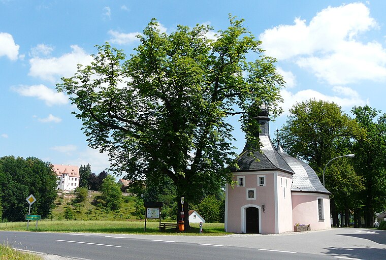
St. Johannes Nepomuk (Waldeck)
Church

Photo: PeterBraun74, CC BY-SA 4.0.
St. Johannes Nepomuk (Waldeck) is a church.
Places in the Area
Nearby places include Erbendorf and Zessau.
Erbendorf
Town
Erbendorf is a town in the Upper Palatinate region of Germany. As of December, 2006, the town has a population of 5,341. The following villages are incorporated into the town: Aschenhof, Birkenreuth, Boxdorf, Eppenhof, Frodersreuth, Glashütte, Gössenreuth…

Kusch
- Type: Mountain saddle with an elevation of 561 metres
- Category: landform
- Location: Kemnath, Tirschenreuth, Upper Palatinate, Bavaria, Germany, Central Europe, Europe
- View on OpenStreetMap
Latitude
49.8358° or 49° 50′ 9″ northLongitude
11.9693° or 11° 58′ 9″ eastElevation
561 metres (1,841 feet)Open location code
8FXHRXP9+8POpenStreetMap ID
node 6183514675OpenStreetMap feature
natural=saddle
This page is based on OpenStreetMap, Wikidata, and Wikimedia Commons.
We’d love your help improving our open data sources. Thank you for contributing.
Satellite Map
Discover Kusch from above in high-definition satellite imagery.
Places with the Same Name
Discover other places named “Kusch”.
Localities in the Area
Explore places such as Albenreuth and Atzmannsberg.
Notable Places Nearby
Highlights include Kuschberg and Schwarzberg.
Upper Palatinate: Must-Visit Destinations
Delve into Regensburg, Amberg, Cham, and Schwandorf.
Curious Mountain Saddles to Discover
Uncover intriguing mountain saddles from every corner of the globe.
About Mapcarta. Data © OpenStreetMap contributors and available under the Open Database License". Text is available under the CC BY-SA 4.0 license, except for photos, directions, and the map. Photo: Wikimedia, CC0.