Militärstädtchen Nr. 7
Militärstädtchen Nr. 7 is in Potsdam, Brandenburg. Militärstädtchen Nr. 7 is situated nearby to the park Mirbach-Wäldchen, as well as near the ruins Königliches Landhaus am Pfingstberg.| Tap on a place to explore it |
Places of Interest Nearby
Highlights include Lepsius House Potsdam and Pfingstkirche (Potsdam).
Lepsius House Potsdam
Museum
 Lepsiushaus is a house museum in Potsdam, Germany. Johannes Lepsius was a German humanist, philosopher, historian, and Armenian human-rights activist. Lepsiushaus is the house where he lived from 1908 to 1926. Lepsius House Potsdam is situated 230 metres north of Militärstädtchen Nr. 7.
Pfingstkirche (Potsdam)
Church

Photo: Wikimedia, Public domain.
Pfingstkirche (Potsdam) is a church, which is situated 170 metres southwest of Militärstädtchen Nr. 7.
Marmorpalais

Photo: Maksim de, CC BY-SA 3.0.
The Marmorpalais is a former royal residence in Potsdam, near Berlin in Germany, built on the grounds of the extensive Neuer Garten on the shores of the Heiliger See. Marmorpalais is situated 540 metres southeast of Militärstädtchen Nr. 7.
Places in the Area
Nearby places include Alexandrowka and Dutch Quarter.
Alexandrowka
Locality

Photo: A.Savin, CC BY-SA 3.0.
The Russian colony of Alexandrowka is located north of downtown Potsdam. It was built in 1826-1827 by King Frederick William III of Prussia for the last twelve Russian singers in a choir that had previously 62 members.
Dutch Quarter
Locality

Photo: Liglioto, CC BY-SA 4.0.
The Dutch Quarter is a neighborhood in Potsdam, Germany, consisting of 134 red Dutch brick buildings, almost all of which have been renovated. It was built from 1733 to 1740 and designed by Jan Bouman following the order of Frederick William I of Prussia, who invited talented Dutch craftsmen to settle there.
Bornstedt
Suburb
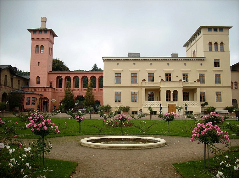
Photo: Jwaller, CC BY-SA 3.0.
Bornstedt is a borough of Potsdam, Germany. Located north of Sanssouci Park and the Orangery Palace, it is known for the Bornstedt Crown Estate, former residence of Princess Royal Victoria, and the Bornstedt Cemetery with numerous tombs of famous personages.
Militärstädtchen Nr. 7
- Type: Information
- Wheelchair access: limited
- Category: tourism
- Location: Potsdam, Brandenburg, Germany, Central Europe, Europe
- View on OpenStreetMap
Latitude
52.41636° or 52° 24′ 59″ northLongitude
13.06416° or 13° 3′ 51″ eastOpen location code
9F4MC387+GMOpenStreetMap ID
node 6189741162OpenStreetMap feature
tourism=informationOpenStreetMap attribute
wheelchair=limited
This page is based on OpenStreetMap, Wikidata, and Wikimedia Commons.
We’d love your help improving our open data sources. Thank you for contributing.
Satellite Map
Discover Militärstädtchen Nr. 7 from above in high-definition satellite imagery.
Notable Places Nearby
Highlights include Königliches Landhaus am Pfingstberg and Mirbach-Wäldchen.
Nearby Places
Explore places such as Evangelische Grundschule Potsdam - Blaues Haus and Besucherinformationszentrum.
Brandenburg: Must-Visit Destinations
Delve into Cottbus, Frankfurt an der Oder, Brandenburg an der Havel, and Oranienburg.
Curious Places to Discover
Uncover intriguing places from every corner of the globe.
About Mapcarta. Data © OpenStreetMap contributors and available under the Open Database License". Text is available under the CC BY-SA 4.0 license, except for photos, directions, and the map. Photo: Iotatau, CC BY-SA 3.0.