Dampflock Pilsstube
Dampflock Pilsstube is a pub in Frankfurt, South Hesse, Hesse. Dampflock Pilsstube is situated nearby to the church St. Markuskirche, as well as near the fire station Feuer- und Rettungswache 3.| Tap on a place to explore it |
Places of Interest Nearby
Highlights include St. Markuskirche and Christuskirche (Frankfurt-Nied).
St. Markuskirche
Church
 St. Markuskirche is a church, which is situated 140 metres west of Dampflock Pilsstube.
Christuskirche (Frankfurt-Nied)
Church
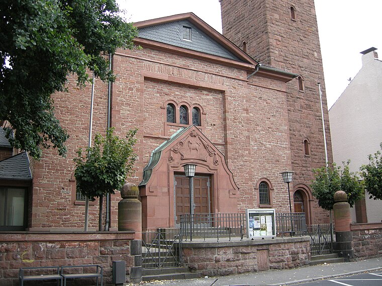
Photo: Joker, CC BY-SA 3.0.
Christuskirche (Frankfurt-Nied) is a church, which is situated 360 metres northwest of Dampflock Pilsstube.
Frankfurt-Nied station
Railway stop
 Frankfurt-Nied station is a station in the district of Nied of the city of Frankfurt in the German state of Hesse on the Main-Lahn Railway. It is now served only by lines S1 and S 2 of the Rhine-Main S-Bahn. Frankfurt-Nied station is situated 430 metres north of Dampflock Pilsstube.
Places in the Area
Nearby places include Nied and Kelsterbacher Terrasse.
Nied
Suburb

Photo: Dontworry, CC BY-SA 3.0.
Nied is a quarter of Frankfurt am Main, Germany. It is part of the Ortsbezirk West and is subdivided into the Stadtbezirke Nied-Nord and Nied-Süd.
Kelsterbacher Terrasse
Locality

Photo: Frank Behnsen, CC BY-SA 3.0.
Kelsterbacher Terrasse is a locality, which is situated 3½ km south of Dampflock Pilsstube.
Friedrich-Ebert-Siedlung (Neues Frankfurt)
Neighborhood

Photo: Gaki64, CC BY-SA 4.0.
Friedrich-Ebert-Siedlung (Neues Frankfurt) is a neighborhood, which is situated 4 km east of Dampflock Pilsstube.
Dampflock Pilsstube
- Type: Pub
- Wheelchair access: no
- Location: Frankfurt, South Hesse, Hesse, Germany, Central Europe, Europe
- View on OpenStreetMap
Latitude
50.0986° or 50° 5′ 55″ northLongitude
8.56984° or 8° 34′ 11″ eastOpen location code
9F2C3HX9+CWOpenStreetMap ID
node 620046685OpenStreetMap feature
amenity=pubOpenStreetMap attribute
wheelchair=no
This page is based on OpenStreetMap, Wikidata, and Wikimedia Commons.
We’d love your help improving our open data sources. Thank you for contributing.
Satellite Map
Discover Dampflock Pilsstube from above in high-definition satellite imagery.
Notable Places Nearby
Highlights include Feuer- und Rettungswache 3 and Freiwillige Feuerwehr Nied.
Nearby Places
Explore places such as Am Treppchen and Dressler, Johanna und Monika-Maria.
South Hesse: Must-Visit Destinations
Delve into Darmstadt, Bensheim, Lorsch, and Heppenheim.
Curious Pubs to Discover
Uncover intriguing pubs from every corner of the globe.
About Mapcarta. Data © OpenStreetMap contributors and available under the Open Database License". Text is available under the CC BY-SA 4.0 license, except for photos, directions, and the map. Photo: Mylius, GFDL.