Wicküler Park
Wicküler Park is a parking area in Wuppertal, Düsseldorf, North Rhine-Westphalia. Wicküler Park is situated nearby to the shopping center Wicküler City, as well as near the post office Postfiliale 659.| Tap on a place to explore it |
- Type: Parking area
- Parking: surface
- Wheelchair access: yes
Places of Interest Nearby
Highlights include Wicküler City and Bibelmuseum.
Wicküler City
Shopping center

Photo: Der-wuppertaler, CC BY-SA 4.0.
Wicküler City is a shopping center, which is situated 130 metres northwest of Wicküler Park.
Bibelmuseum
Museum

Photo: Atamari, CC BY-SA 3.0.
Bibelmuseum is situated 240 metres southwest of Wicküler Park.
Waldfrieden Sculpture Park
Museum
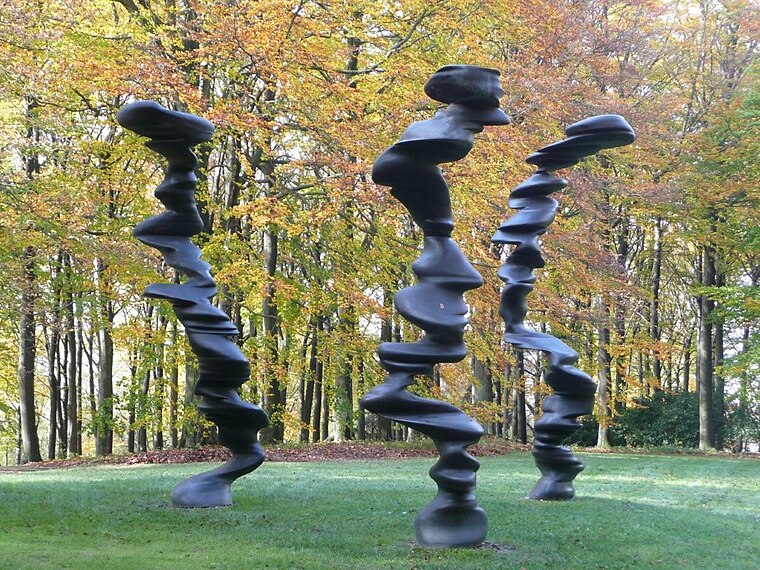
Photo: Gerardus, Public domain.
Waldfrieden Sculpture Park is a museum, which is situated 380 metres south of Wicküler Park.
Places in the Area
Nearby places include Elberfeld and Luisenstraße.
Elberfeld
Suburb

Photo: Wikimedia, Public domain.
Elberfeld is a municipal subdivision of the German city of Wuppertal; it was an independent town until 1929.

Lichtscheid
Neighborhood

Photo: Krd, CC BY-SA 4.0.
The Lichtscheid is the highest hill of the German city of Wuppertal. It has an elevation of 350 metres.
Wicküler Park
- Category: transportation
- Location: Wuppertal, Düsseldorf, Bergisches Land, North Rhine-Westphalia, Germany, Central Europe, Europe
- View on OpenStreetMap
Latitude
51.25593° or 51° 15′ 21″ northLongitude
7.16654° or 7° 9′ 60″ eastOpen location code
9F397548+9JOpenStreetMap ID
node 620081642OpenStreetMap feature
amenity=parkingOpenStreetMap attribute
parking=surfaceOpenStreetMap attribute
wheelchair=yes
This page is based on OpenStreetMap, Wikidata, and Wikimedia Commons.
We’d love your help improving our open data sources. Thank you for contributing.
Satellite Map
Discover Wicküler Park from above in high-definition satellite imagery.
Places with the Same Name
Discover other places named “Wicküler Park”.
Notable Places Nearby
Highlights include Wicküler City and Postfiliale 659.
Nearby Places
Explore places such as Thomas Philipps Sonderposten and Das Futterhaus.
Bergisches Land: Must-Visit Destinations
Delve into Solingen, Bergisch Gladbach, Remscheid, and Gummersbach.
Curious Parking Areas to Discover
Uncover intriguing parking areas from every corner of the globe.
About Mapcarta. Data © OpenStreetMap contributors and available under the Open Database License". Text is available under the CC BY-SA 4.0 license, except for photos, directions, and the map. Photo: Wikimedia, CC0.