Eisenberger Sattel
Eisenberger Sattel is a mountain saddle in Badersdorf, Oberwart District, Burgenland and has an elevation of 350 metres. Eisenberger Sattel is situated nearby to the village Badersdorf, as well as near Woppendorf.| Tap on a place to explore it |
Places of Interest
Highlights include Filialkirche hl. Johannes der Täufer, Woppendorf and Holy Trinity Chapel.
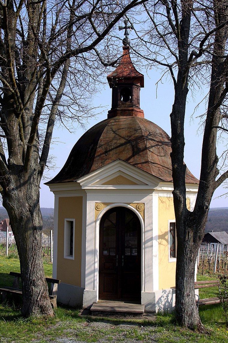
Filialkirche hl. Johannes der Täufer, Woppendorf
Church

Photo: Stefan Fadinger, CC BY-SA 4.0.
Filialkirche hl. Johannes der Täufer, Woppendorf is a church.

Places in the Area
Nearby places include Vaskeresztes and Felsőcsatár.
Vaskeresztes
Village

Photo: Darinko, Public domain.
Vaskeresztes is a village in Vas County, Hungary.

Eisenberger Sattel
- Type: Mountain saddle with an elevation of 350 metres
- Categories: mountain pass and landform
- Location: Badersdorf, Oberwart District, Burgenland, Austria, Central Europe, Europe
- View on OpenStreetMap
Latitude
47.1913° or 47° 11′ 29″ northLongitude
16.3916° or 16° 23′ 30″ eastElevation
350 metres (1,148 feet)Open location code
8FVR59RR+GJOpenStreetMap ID
node 6210034593OpenStreetMap feature
natural=saddleWikidata ID
Q133693012
This page is based on OpenStreetMap, Wikidata, and Wikimedia Commons.
We’d love your help improving our open data sources. Thank you for contributing.
Satellite Map
Discover Eisenberger Sattel from above in high-definition satellite imagery.
In Other Languages
“Eisenberger Sattel” goes by many names.
- German: “Eisenberger Sattel”
Localities in the Area
Explore places such as Badersdorf and Woppendorf.
Notable Places Nearby
Highlights include Steinbruch Badersdorf and Friedhof Badersdorf.
Burgenland: Must-Visit Destinations
Delve into Eisenstadt, Neusiedl am See, Rust, and Güssing.
Curious Mountain Saddles to Discover
Uncover intriguing mountain saddles from every corner of the globe.
About Mapcarta. Data © OpenStreetMap contributors and available under the Open Database License". Text is available under the CC BY-SA 4.0 license, except for photos, directions, and the map. Photo: Wikimedia, CC BY-SA 4.0.