Tagbau Oberdorf 1977-2004
Tagbau Oberdorf 1977-2004 is in Voitsberg, Styria. Tagbau Oberdorf 1977-2004 is situated nearby to Schaufelradbagger, as well as near GKB VB 10.06 ‘Roter Blitz’.| Tap on a place to explore it |
Places of Interest Nearby
Highlights include Burg Obervoitsberg and Filialkirche hl. Michael, Voitsberg.
Burg Obervoitsberg
Castle
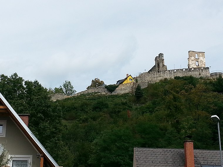
Photo: Liuthalas, CC BY-SA 3.0 at.
Burg Obervoitsberg is a castle in Voitsberg, Styria, Austria. Burg Obervoitsberg is situated 560 metres southwest of Tagbau Oberdorf 1977-2004.
Filialkirche hl. Michael, Voitsberg
Church

Photo: Liuthalas, CC BY-SA 3.0 at.
Filialkirche hl. Michael, Voitsberg is a church, which is situated 1 km southwest of Tagbau Oberdorf 1977-2004.
Gustav-Adolf-Kirche Voitsberg
Church

Photo: Wikimedia, CC BY-SA 3.0 at.
Gustav-Adolf-Kirche Voitsberg is a church, which is situated 1¼ km southwest of Tagbau Oberdorf 1977-2004.
Places in the Area
Nearby places include Piberegg and Södingberg.
Piberegg
Village
Piberegg is a former municipality in the district of Voitsberg in the Austrian state of Styria. Since the 2015 Styria municipal structural reform, it is part of the municipality Bärnbach. Piberegg is situated 5 km northwest of Tagbau Oberdorf 1977-2004.
Södingberg
Village
Södingberg is a former municipality in the district of Voitsberg in the Austrian state of Styria. Since the 2015 Styria municipal structural reform, it is part of the municipality Geistthal-Södingberg. Södingberg is situated 6 km north of Tagbau Oberdorf 1977-2004.
Kohlschwarz
Hamlet
Kohlschwarz is a former municipality in the district of Voitsberg in the Austrian state of Styria. Since the 2015 Styria municipal structural reform, it is part of the municipality Kainach bei Voitsberg. Kohlschwarz is situated 8 km north of Tagbau Oberdorf 1977-2004.
Tagbau Oberdorf 1977-2004
- Type: Sign
- Categories: information and tourism
- Location: Voitsberg, Voitsberg District, Styria, Austria, Central Europe, Europe
- View on OpenStreetMap
Latitude
47.0555° or 47° 3′ 20″ northLongitude
15.15659° or 15° 9′ 24″ eastOpen location code
8FVQ3544+5JOpenStreetMap ID
node 6240509630OpenStreetMap feature
tourism=information
This page is based on OpenStreetMap, Wikidata, and Wikimedia Commons.
We’d love your help improving our open data sources. Thank you for contributing.
Satellite Map
Discover Tagbau Oberdorf 1977-2004 from above in high-definition satellite imagery.
Notable Places Nearby
Highlights include Schaufelradbagger and GKB VB 10.06 ‘Roter Blitz’.
Nearby Places
Explore places such as Pumpstation Zangtal and Tregist Werk Zangtal.
Styria: Must-Visit Destinations
Delve into Graz, Leoben, Bruck an der Mur, and Kapfenberg.
Curious Places to Discover
Uncover intriguing places from every corner of the globe.
About Mapcarta. Data © OpenStreetMap contributors and available under the Open Database License". Text is available under the CC BY-SA 4.0 license, except for photos, directions, and the map. Photo: Kmarka, CC BY-SA 3.0.