Angerer Freiberg
Angerer Freiberg is a locality in Bad Hofgastein, St. Johann im Pongau District, Salzburg. Angerer Freiberg is situated nearby to the locality Skizentrum Angertal, as well as near Rasteckhöhe.| Tap on a place to explore it |
Places of Interest
Highlights include Stubnerkogel and Angerschluchtbrücke.


Weitmoserschlössl
Castle
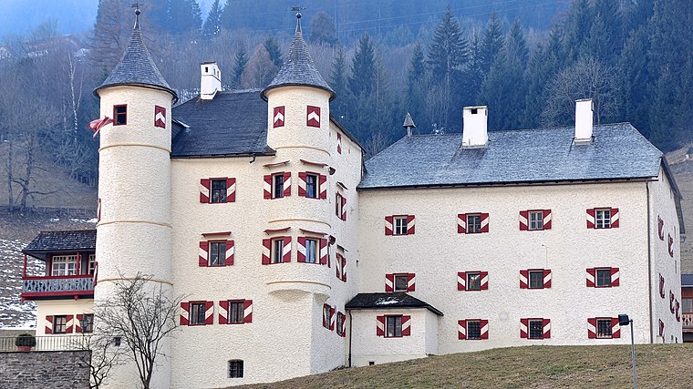
Photo: Triq, CC BY-SA 3.0.
Weitmoserschlössl is a castle, which is situated 3½ km north of Angerer Freiberg.
Places in the Area
Nearby places include Kötschachdorf and Badbruck.
Kötschachdorf
Hamlet

Photo: Man77, CC BY-SA 4.0.
Kötschachdorf is a hamlet, which is situated 3 km east of Angerer Freiberg.
Badbruck
Hamlet

Photo: Herzi Pinki, CC BY-SA 4.0.
Badbruck is a hamlet, which is situated 3½ km east of Angerer Freiberg.
Bad Gastein

Photo: Usien, CC BY-SA 4.0.
Bad Gastein is a small city in the eastern part of the Alps, in the Salzburg region in Austria. It is located in the middle of the Hohe Tauern National Park in the Salzburg region, and gets visitors all year around.
Angerer Freiberg
- Type: Locality
- Location: Bad Hofgastein, St. Johann im Pongau District, Salzburg, Austria, Central Europe, Europe
- View on OpenStreetMap
Latitude
47.13216° or 47° 7′ 56″ northLongitude
13.09605° or 13° 5′ 46″ eastOpen location code
8FVM43JW+VCOpenStreetMap ID
node 6242001665OpenStreetMap feature
place=locality
This page is based on OpenStreetMap, Wikidata, and Wikimedia Commons.
We’d love your help improving our open data sources. Thank you for contributing.
Satellite Map
Discover Angerer Freiberg from above in high-definition satellite imagery.
Localities in the Area
Explore places such as Skizentrum Angertal and Rasteckhöhe.
Notable Places Nearby
Highlights include Ski Gastein - Stubnerkogel/Schlossalm and Lechner Kapelle.
Salzburg: Must-Visit Destinations
Delve into Salzburg, Bischofshofen, Bad Gastein, and Zell am See.
Curious Localities to Discover
Uncover intriguing localities from every corner of the globe.
About Mapcarta. Data © OpenStreetMap contributors and available under the Open Database License". Text is available under the CC BY-SA 4.0 license, except for photos, directions, and the map. Photo: Wikimedia, CC BY-SA 2.5.