Hohler Lerchensporn
Hohler Lerchensporn is in Groitzsch, Leipzig, Saxony. Hohler Lerchensporn is situated nearby to the sports venue Schützenverein Groitzsch 1735/1991 e.V., as well as near the health club AZUR - Fitness & Wellness.| Tap on a place to explore it |
Places of Interest Nearby
Highlights include Kgl.-sächs. Postmeilenstein Groitzsch Grenzübergangsstein and Kgl.-sächs. Postmeilenstein Groitzsch Halbmeilenstein.
Kgl.-sächs. Postmeilenstein Groitzsch Grenzübergangsstein
Historic site
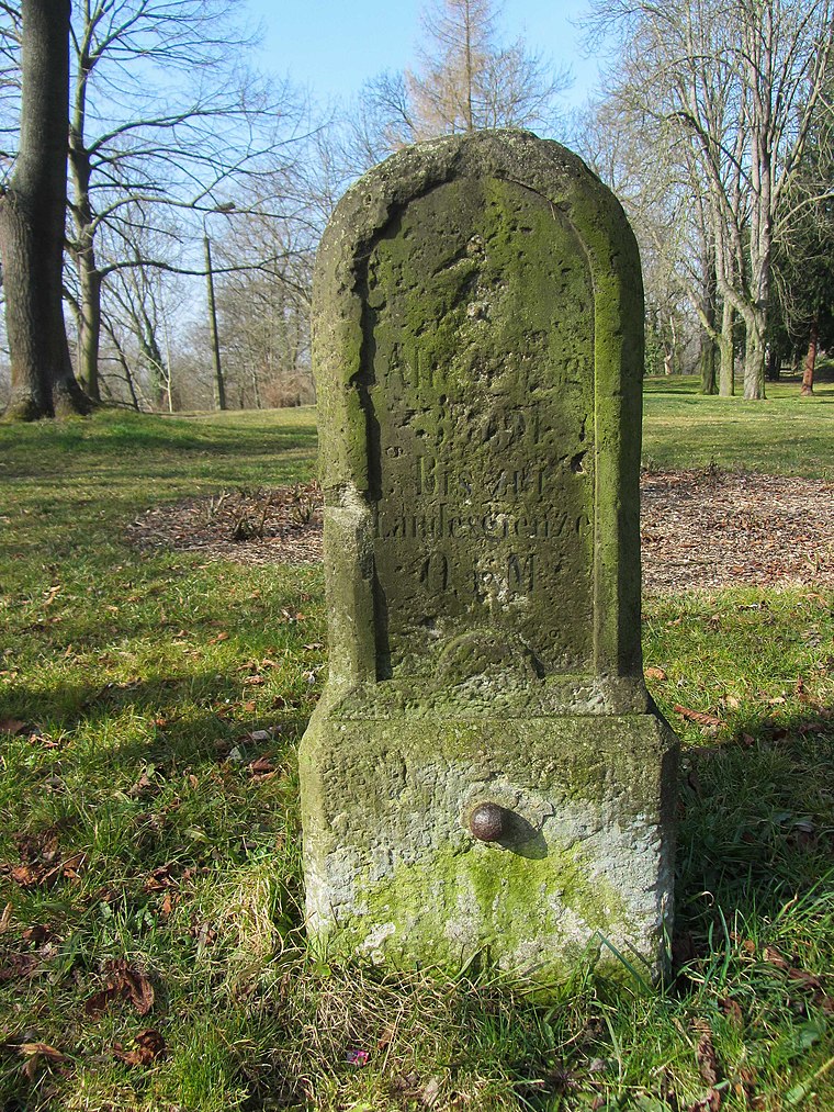
Photo: Radler59, CC BY-SA 3.0.
Kgl.-sächs. Postmeilenstein Groitzsch Grenzübergangsstein is a historic site, which is situated 710 metres northeast of Hohler Lerchensporn.
Kgl.-sächs. Postmeilenstein Groitzsch Halbmeilenstein
Historic site
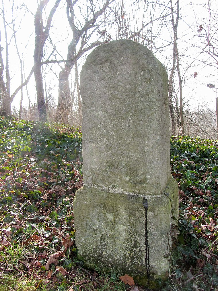
Photo: Radler59, CC BY-SA 3.0.
Kgl.-sächs. Postmeilenstein Groitzsch Halbmeilenstein is a historic site, which is situated 710 metres northeast of Hohler Lerchensporn.
Kgl.-sächs. Postmeilenstein Groitzsch Gedenkstein
Historic site

Photo: Radler59, CC BY-SA 3.0.
Kgl.-sächs. Postmeilenstein Groitzsch Gedenkstein is a historic site, which is situated 720 metres northeast of Hohler Lerchensporn.
Places in the Area
Nearby places include Altengroitzsch and Pegau.

Pegau
Town

Photo: Wikimedia, CC BY-SA 4.0.
Pegau is a town in the Leipzig district in Saxony, Germany, situated in a fertile plain, on the White Elster, 18 m. S.W. from Leipzig by the railway to Zeitz.
Nöthnitz
Suburb

Photo: Jwaller, CC BY-SA 4.0.
Nöthnitz is a suburb, which is situated 3 km south of Hohler Lerchensporn.
Hohler Lerchensporn
- Type: Sign
- Categories: information and tourism
- Location: Groitzsch, Leipzig, Saxony, Germany, Central Europe, Europe
- View on OpenStreetMap
Latitude
51.15339° or 51° 9′ 12″ northLongitude
12.27096° or 12° 16′ 16″ eastOpen location code
9F3J573C+99OpenStreetMap ID
node 6242914790OpenStreetMap feature
tourism=information
This page is based on OpenStreetMap, Wikidata, and Wikimedia Commons.
We’d love your help improving our open data sources. Thank you for contributing.
Satellite Map
Discover Hohler Lerchensporn from above in high-definition satellite imagery.
Notable Places Nearby
Highlights include Schützenverein Groitzsch 1735/1991 e.V. and AZUR - Fitness & Wellness.
Nearby Places
Explore places such as Wiesen-Margerite and Kernbeißer.
Saxony: Must-Visit Destinations
Delve into Dresden, Leipzig, Chemnitz, and Meißen.
Curious Places to Discover
Uncover intriguing places from every corner of the globe.
About Mapcarta. Data © OpenStreetMap contributors and available under the Open Database License". Text is available under the CC BY-SA 4.0 license, except for photos, directions, and the map. Photo: Taxiarchos228, FAL.