ÖR-Valentin-Deutschmann-Platz
ÖR-Valentin-Deutschmann-Platz is a square in Grafenstein, Klagenfurt-Land District, Carinthia. ÖR-Valentin-Deutschmann-Platz is situated nearby to the town hall Grafenstein, as well as near the public building Veranstaltungszentrum Hambruschsaal.| Tap on a place to explore it |
Places of Interest Nearby
Highlights include Grafenstein and Aufnahmsgebäude Bahnhof Grafenstein.
Grafenstein
Town hall
Grafenstein is a town in the district of Klagenfurt-Land in the Austrian state of Carinthia.
Aufnahmsgebäude Bahnhof Grafenstein
Railway station
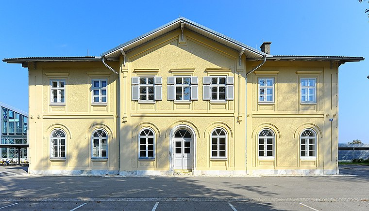
Photo: Johann Jaritz, CC BY-SA 3.0.
Aufnahmsgebäude Bahnhof Grafenstein is a railway station, which is situated 490 metres west of ÖR-Valentin-Deutschmann-Platz.
Aufbahrungshalle Grafenstein
Chapel

Photo: Johann Jaritz, CC BY-SA 4.0.
Aufbahrungshalle Grafenstein is a chapel, which is situated 520 metres south of ÖR-Valentin-Deutschmann-Platz.
Places in the Area
Nearby places include Tainach and Sankt Veit im Jauntal.
Tainach
Village

Photo: Naturpuur, CC BY-SA 4.0.
Tainach is a village, which is situated 6 km east of ÖR-Valentin-Deutschmann-Platz.
Sankt Veit im Jauntal
Village

Photo: Streunerich, CC BY-SA 4.0.
Sankt Veit im Jauntal is a village, which is situated 7 km southeast of ÖR-Valentin-Deutschmann-Platz.
Lipizach
Hamlet

Photo: Streunerich, CC BY-SA 4.0.
Lipizach is a hamlet, which is situated 8 km west of ÖR-Valentin-Deutschmann-Platz.
ÖR-Valentin-Deutschmann-Platz
- Type: Square
- Category: locality
- Location: Grafenstein, Klagenfurt-Land District, Carinthia, Austria, Central Europe, Europe
- View on OpenStreetMap
Latitude
46.61737° or 46° 37′ 3″ northLongitude
14.46539° or 14° 27′ 55″ eastOpen location code
8FRPJF88+W5OpenStreetMap ID
node 6244092109OpenStreetMap feature
place=square
This page is based on OpenStreetMap, Wikidata, and Wikimedia Commons.
We’d love your help improving our open data sources. Thank you for contributing.
Satellite Map
Discover ÖR-Valentin-Deutschmann-Platz from above in high-definition satellite imagery.
Notable Places Nearby
Highlights include Polizeiinspektion Grafenstein and Veranstaltungszentrum Hambruschsaal.
Nearby Places
Explore places such as Grafenstein Gemeindeamt and Grafenstein Gemeindeamt.
Carinthia: Must-Visit Destinations
Delve into Klagenfurt, Villach, Wörthersee, and Spittal an der Drau.
Curious Squares to Discover
Uncover intriguing squares from every corner of the globe.
About Mapcarta. Data © OpenStreetMap contributors and available under the Open Database License". Text is available under the CC BY-SA 4.0 license, except for photos, directions, and the map. Photo: Wikimedia, CC BY-SA 3.0.