Wasserentnahmestelle Brücke. 1
Wasserentnahmestelle Brücke. 1 is in Bad Tölz, Upper Bavaria, Bavaria. Wasserentnahmestelle Brücke. 1 is situated nearby to the church St. Martin Ellbach, as well as near Ellbacher Moor.| Tap on a place to explore it |
Places of Interest Nearby
Highlights include Hacker-Pschorr Arena and Bad Tölz railway station.
Hacker-Pschorr Arena
Stadium
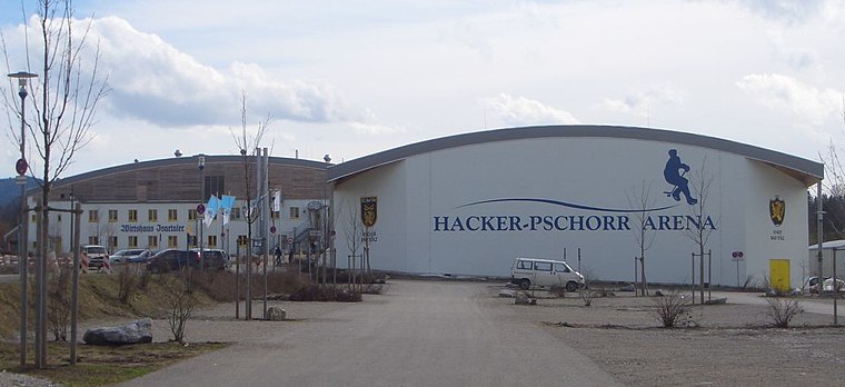
Photo: Daniel Hüneborg, CC BY 2.0.
Hacker-Pschorr Arena is a stadium, which is situated 2½ km south of Wasserentnahmestelle Brücke. 1.
Bad Tölz railway station
Railway station

Photo: Renardo la vulpo, CC0.
Bad Tölz railway station is situated 2½ km southwest of Wasserentnahmestelle Brücke. 1.
Museum of the history of the city of Bad Toelz
Museum

Photo: Stefan Karl, CC BY-SA 4.0.
Museum of the history of the city of Bad Toelz is situated 3 km southwest of Wasserentnahmestelle Brücke. 1.
Places in the Area
Nearby places include Ellbach and Eichmühle.


Wasserentnahmestelle Brücke. 1
- Type: Body of water
- Location: Bad Tölz, Bad Tölz-Wolfratshausen, Upper Bavaria, Bavaria, Germany, Central Europe, Europe
- View on OpenStreetMap
Latitude
47.77994° or 47° 46′ 48″ northLongitude
11.58727° or 11° 35′ 14″ eastOpen location code
8FVHQHHP+XWOpenStreetMap ID
node 6259752815OpenStreetMap feature
natural=water
This page is based on OpenStreetMap, Wikidata, and Wikimedia Commons.
We’d love your help improving our open data sources. Thank you for contributing.
Satellite Map
Discover Wasserentnahmestelle Brücke. 1 from above in high-definition satellite imagery.
Notable Places Nearby
Highlights include St. Martin Ellbach and Ellbacher Moor.
Nearby Places
Explore places such as Ellbachmoor and Kriegerdenkmal.
Upper Bavaria: Must-Visit Destinations
Delve into Munich, Ingolstadt, Rosenheim, and Dachau.
Curious Places to Discover
Uncover intriguing places from every corner of the globe.
About Mapcarta. Data © OpenStreetMap contributors and available under the Open Database License". Text is available under the CC BY-SA 4.0 license, except for photos, directions, and the map. Photo: Aconcagua, CC BY-SA 3.0.