Kingdom Hall Jehovah’s Witnesses
Kingdom Hall Jehovah’s Witnesses is a place of worship in Cham, Upper Palatinate, Bavaria which is located on Prof.-Heigl-Straße. Kingdom Hall Jehovah’s Witnesses is situated nearby to the village Pösing.| Tap on a place to explore it |
- Type: Place of worship
- Also known as: “Königreichssaal Jehovas Zeugen”
- Address: Prof.-Heigl-Straße 32, Cham, 93413
Places of Interest Nearby
Highlights include Cham station and Klosterkirche Maria Hilf.
Cham station
Railway station

Photo: Joachim Lutz, CC BY-SA 4.0.
Cham station is a railway station in the municipality of Cham, located in the Cham district in Bavaria, Germany. The station is located in the Upper Palatinate administrative district. Cham station is situated 2 km east of Kingdom Hall Jehovah’s Witnesses.
Klosterkirche Maria Hilf
Church

Photo: Wikimedia, CC BY-SA 2.5.
Klosterkirche Maria Hilf is a church, which is situated 2½ km east of Kingdom Hall Jehovah’s Witnesses.
Erlöserkirche
Church

Photo: Asurnipal, CC BY-SA 4.0.
Erlöserkirche is a church, which is situated 2½ km east of Kingdom Hall Jehovah’s Witnesses.
Places in the Area
Nearby places include Pösing and Roding.
Pösing
Village

Photo: Pedro ximenez, CC BY-SA 3.0 de.
Pösing is a municipality in the district of Cham in Bavaria in Germany. Pösing is situated 6 km west of Kingdom Hall Jehovah’s Witnesses.
Roding
Town
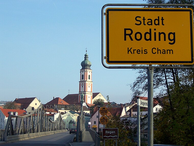
Photo: Wiki82, Public domain.
Roding is a town in the district of Cham, in Bavaria, Germany, near the Czech border. Roding is situated 9 km west of Kingdom Hall Jehovah’s Witnesses.
Stamsried
Village

Photo: O DM, CC BY-SA 3.0.
Stamsried is a village and municipality in the district of Cham in the Upper Palatinate region of Bavaria, Germany, near the Czech border. It is also located in the Roman Catholic diocese of Regensburg. Stamsried is situated 9 km northwest of Kingdom Hall Jehovah’s Witnesses.
Kingdom Hall Jehovah’s Witnesses
- Category: religion
- Location: Cham, Cham, Upper Palatinate, Bavaria, Germany, Central Europe, Europe
- View on OpenStreetMap
Latitude
49.21539° or 49° 12′ 55″ northLongitude
12.63209° or 12° 37′ 56″ eastOpen location code
8FXJ6J8J+5ROpenStreetMap ID
node 6267297586OpenStreetMap feature
amenity=place_of_worship
This page is based on OpenStreetMap, Wikidata, and Wikimedia Commons.
We’d love your help improving our open data sources. Thank you for contributing.
Satellite Map
Discover Kingdom Hall Jehovah’s Witnesses from above in high-definition satellite imagery.
Places with the Same Name
Discover other places named “Kingdom Hall Jehovah’s Witnesses”.
Notable Places Nearby
Highlights include Kindergarten Altenmarkt and Industrie und Handwerkskammer.
Nearby Places
Explore places such as Michelsdorf, Martinstraße and Cham, Michelsdorf, Ortsmitte.
Upper Palatinate: Must-Visit Destinations
Delve into Regensburg, Amberg, Schwandorf, and Grafenwöhr.
Curious Place Of Worships to Discover
Uncover intriguing place of worships from every corner of the globe.
About Mapcarta. Data © OpenStreetMap contributors and available under the Open Database License". Text is available under the CC BY-SA 4.0 license, except for photos, directions, and the map. Photo: Romanist, CC BY-SA 4.0.