Mandagana
Mandagana is a peak in Loiu, Biscay, Basque Country and has an elevation of 57 metres. Mandagana is situated nearby to the neighborhood Zangroiz, as well as near Izartza.| Tap on a place to explore it |
Places of Interest
Highlights include Guggenheim Museum Bilbao and Bilbao Airport.
Guggenheim Museum Bilbao
Museum
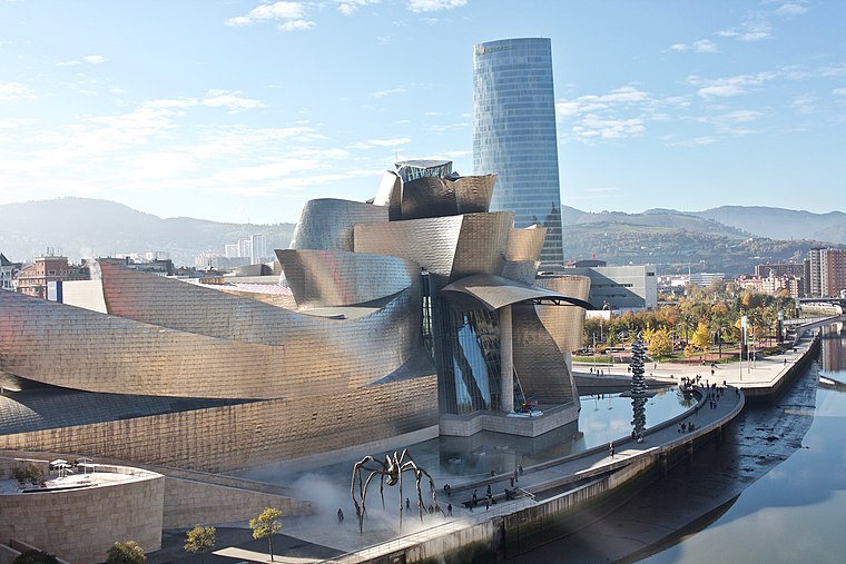
Photo: Naotake Murayama, CC BY 2.0.
The Guggenheim Museum Bilbao is a museum of modern and contemporary art in Bilbao, Biscay, Spain. It is one of several museums affiliated to the Solomon R.
Bilbao Airport
Aerodrome
Bilbao Airport is a minor international airport located 9 km north of Bilbao, in the municipality of Loiu, in Biscay. It is the largest airport in the Basque Country and northern Spain, with 6,336,441 passengers in 2023.
San Mamés Stadium
Stadium
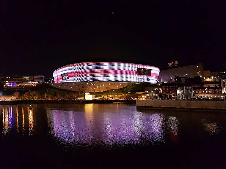
Photo: Xabier, CC BY-SA 4.0.
The San Mamés Stadium is an all-seater football stadium in Rafael Moreno Pitxitxi Kalea, Bilbao, Basque Country, Spain. Inaugurated on 16 September 2013, the stadium replaced the "old" San Mamés as the home of Athletic Bilbao.
Places in the Area
Nearby places include Bilbao and Erandio.
Bilbao

Photo: Archaeodontosaurus, CC BY-SA 3.0.
Bilbao, with a population of about 350,000, is the largest city in Spain's Basque Country. Bilbao is perhaps the best place in the world to experience the ancient culture and language of the Basque people, which has stubbornly held its own over thousands of years and is now completely unlike any modern-day culture in Europe.
Erandio
Town
 Erandio is a town and municipality located in the province of Biscay, in the autonomous community of Basque Country, northern Spain.

Mandagana
- Type: Peak with an elevation of 57 metres
- Category: landform
- Location: Loiu, Biscay, Basque Country, Northern Spain, Spain, Iberia, Europe
- View on OpenStreetMap
Latitude
43.2913° or 43° 17′ 29″ northLongitude
-2.9334° or 2° 56′ 0″ westElevation
57 metres (187 feet)Open location code
8CMV73R8+GJOpenStreetMap ID
node 6292986547OpenStreetMap feature
natural=peak
This page is based on OpenStreetMap, Wikidata, and Wikimedia Commons.
We’d love your help improving our open data sources. Thank you for contributing.
Satellite Map
Discover Mandagana from above in high-definition satellite imagery.
Localities in the Area
Explore places such as Zangroiz and Izartza.
Notable Places Nearby
Highlights include Cementerio de Sondika and Gorondagana.
Basque Country: Must-Visit Destinations
Delve into Bilbao, San Sebastián, Vitoria-Gasteiz, and Guernica.
Curious Peaks to Discover
Uncover intriguing peaks from every corner of the globe.
About Mapcarta. Data © OpenStreetMap contributors and available under the Open Database License". Text is available under the CC BY-SA 4.0 license, except for photos, directions, and the map. Photo: Ander Abadia Zallo, CC BY 4.0.