Kath. Dompfarramt
Kath. Dompfarramt is an office in Dresden, Saxon Elbland, Saxony. Kath. Dompfarramt is situated nearby to the fountain Widderkopf, as well as near the community center House of the Cathedral.| Tap on a place to explore it |
Places of Interest Nearby
Highlights include Dresden Frauenkirche and Semperoper.
Dresden Frauenkirche
Church
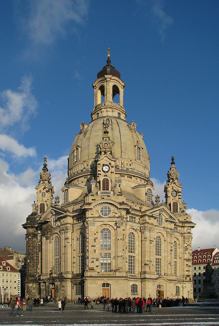
Photo: Netopyr, CC BY-SA 3.0.
The Frauenkirche is a Lutheran church in Dresden, the capital of the German state of Saxony. Destroyed during the Allied firebombing of Dresden towards the end of World War II, the church was reconstructed between 1994 and 2005. Dresden Frauenkirche is situated 230 metres east of Kath. Dompfarramt.
Semperoper
Theater building
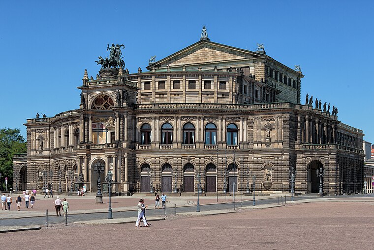
Photo: Avda, CC BY-SA 3.0.
The Semperoper is the opera house of the Sächsische Staatsoper Dresden and the concert hall of the Staatskapelle Dresden. It is also home to the Semperoper Ballett. Semperoper is situated 320 metres northwest of Kath. Dompfarramt.
Dresden Cathedral
Church

Photo: X-Weinzar, CC BY-SA 3.0.
Dresden Cathedral, or the Cathedral of the Holy Trinity, Dresden, previously the Catholic Church of the Royal Court of Saxony, called in German Katholische Hofkirche and since 1980 also known as Kathedrale Sanctissimae Trinitatis, is the Catholic Cathedral of Dresden. Dresden Cathedral is situated 130 metres northwest of Kath. Dompfarramt.
Places in the Area
Nearby places include Innere Altstadt and Wilsdruffer Vorstadt.


Innere Neustadt
Suburb

Photo: Wikimedia, CC BY-SA 4.0.
The Innere Neustadt is a neighborhood in Dresden within the administrative district of Neustadt. The name is derived from "Neue Königliche Stadt", the name given to the former district of Altendresden when it was rebuilt after a fire before 1732.
Kath. Dompfarramt
- Type: Office
- Location: Dresden, Saxon Elbland, Saxony, Germany, Central Europe, Europe
- View on OpenStreetMap
Latitude
51.05254° or 51° 3′ 9″ northLongitude
13.73842° or 13° 44′ 18″ eastOpen location code
9F3M3P3Q+29OpenStreetMap ID
node 6299648597OpenStreetMap feature
office=religion
This page is based on OpenStreetMap, Wikidata, and Wikimedia Commons.
We’d love your help improving our open data sources. Thank you for contributing.
Satellite Map
Discover Kath. Dompfarramt from above in high-definition satellite imagery.
Notable Places Nearby
Highlights include Widderkopf and Ringstechsäule.
Nearby Places
Explore places such as Katholische Akademie des Bistums Dresden-Meißen and Bischofssekreteriat.
Saxon Elbland: Must-Visit Destinations
Delve into Meißen, Riesa, Radebeul, and Freital.
Curious Offices to Discover
Uncover intriguing offices from every corner of the globe.
About Mapcarta. Data © OpenStreetMap contributors and available under the Open Database License". Text is available under the CC BY-SA 4.0 license, except for photos, directions, and the map. Photo: Kreidefossil, CC BY-SA 3.0.