Luchsdörne
Luchsdörne is a peak in Blankenburg, Harz, Saxony-Anhalt and has an elevation of 217 metres. Luchsdörne is situated nearby to the locality Friedrichsberg, as well as near Grüner Hof.| Tap on a place to explore it |
Places of Interest
Highlights include Blankenburg station and Regenstein Mill.
Blankenburg station
Railway station
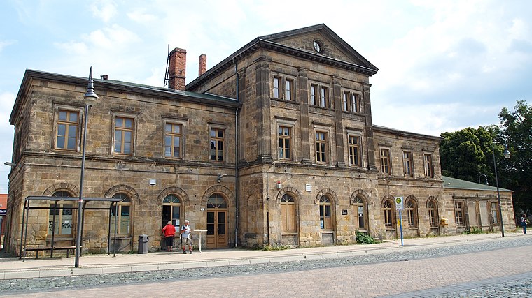
Photo: Angela Huster, CC0.
Blankenburg station is the most important station in Blankenburg in the Saxony-Anhalt district of Harz in central Germany.
Regenstein Mill

Photo: Hejkal, CC BY-SA 3.0 de.
The Regenstein Mill was a water-powered corn and oil mill below Regenstein Castle north of the town of Blankenburg in the county of Harz.
Sandhöhlen

Photo: Jojoo64, CC BY-SA 4.0.
The Sandhöhlen are a natural monument in the German state of Saxony-Anhalt. They are two sand caves known individually as the Große Sandhöhle and Kleine Sandhöhle.
Places in the Area
Nearby places include Langenstein and Westerhausen.
Langenstein
Village

Photo: B.Thomas95, CC BY-SA 4.0.
Langenstein is a village and a former municipality in the district of Harz, in Saxony-Anhalt, Germany. Since 1 January 2010, it is part of the town Halberstadt. The World War II concentration camp Langenstein-Zwieberge was located here.
Westerhausen
Village

Photo: B.Thomas95, CC BY-SA 4.0.
Westerhausen is a village and a former municipality in the district of Harz, in Saxony-Anhalt, Germany. Since 1 September 2010, it is part of the town Thale.
Luchsdörne
- Type: Peak with an elevation of 217 metres
- Category: landform
- Location: Blankenburg, Harz, Saxony-Anhalt, Germany, Central Europe, Europe
- View on OpenStreetMap
Latitude
51.8144° or 51° 48′ 52″ northLongitude
10.9796° or 10° 58′ 46″ eastElevation
217 metres (712 feet)Open location code
9F3GRX7H+QROpenStreetMap ID
node 6305665326OpenStreetMap feature
natural=peak
This page is based on OpenStreetMap, Wikidata, and Wikimedia Commons.
We’d love your help improving our open data sources. Thank you for contributing.
Satellite Map
Discover Luchsdörne from above in high-definition satellite imagery.
Localities in the Area
Explore places such as Friedrichsberg and Grüner Hof.
Notable Places Nearby
Highlights include Feldwebel-Anton-Schmid-Kaserne and Große Sandhöhlen.
Saxony-Anhalt: Must-Visit Destinations
Delve into Magdeburg, Halle, Wittenberg, and Quedlinburg.
Curious Peaks to Discover
Uncover intriguing peaks from every corner of the globe.
About Mapcarta. Data © OpenStreetMap contributors and available under the Open Database License". Text is available under the CC BY-SA 4.0 license, except for photos, directions, and the map. Photo: Mr. TI., CC BY 3.0.