Planina I
Planina I is a bike rental in Kranj, Central Slovenia. Planina I is situated nearby to the shopping center Supernova Qlandia, as well as near the sports venue Športna dvorana Planina.| Tap on a place to explore it |
Places of Interest Nearby
Highlights include Castle Khislstein and Our Lady of the Rosary Church.
Castle Khislstein
Castle
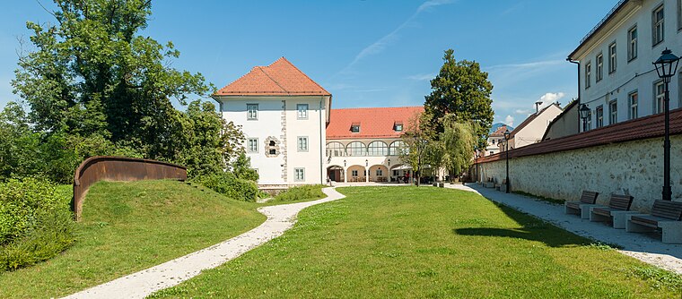
Photo: Meho29, CC BY-SA 4.0.
Kieselstein Castle, also known as Khislstein, is a 13th-century castle in the city of Kranj, in the Upper Carniola region of Slovenia. The castle stands at what was once a defensible point, guarding the city pier and crossing over the river Sava, and was predated on the site by a round 11th-century keep. Castle Khislstein is situated 1 km northwest of Planina I.
Our Lady of the Rosary Church
Church

Photo: Gitanes232, CC BY-SA 4.0.
Our Lady of the Rosary Church is situated 1 km northwest of Planina I.
St. Cantianus and Companions Parish Church
Church

Photo: Meho29, CC BY-SA 3.0.
St. Cantianus and Companions Parish Church is situated 1 km northwest of Planina I.
Places in the Area
Nearby places include Orehek and Huje.
Orehek
Suburb
 Orehek is a former settlement in the Municipality of Kranj in the Upper Carniola region of Slovenia. It now corresponds to the neighborhood of Orehek in Kranj.
Huje
Suburb
Huje is a former settlement in the Municipality of Kranj in the Upper Carniola region of Slovenia. It now corresponds to the neighborhood of Huje in Kranj.
Drulovka
Suburb
 Drulovka is a former settlement in the Municipality of Kranj in the Upper Carniola region of Slovenia. It now corresponds to the neighborhood of Drulovka in Kranj.
Planina I
- Type: Bike rental
- Category: transportation
- Location: Kranj, Central Slovenia, Slovenia, Central Europe, Europe
- View on OpenStreetMap
Latitude
46.23275° or 46° 13′ 58″ northLongitude
14.36323° or 14° 21′ 48″ eastOperator
MO KranjNetwork
KRsKOLESOMOpen location code
8FRP69M7+47OpenStreetMap ID
node 6316562707OpenStreetMap feature
amenity=bicycle_rental
This page is based on OpenStreetMap, Wikidata, and Wikimedia Commons.
We’d love your help improving our open data sources. Thank you for contributing.
Satellite Map
Discover Planina I from above in high-definition satellite imagery.
Notable Places Nearby
Highlights include Supernova Qlandia and Športna dvorana Planina.
Nearby Places
Explore places such as Kranj Stolpnice and Kranj Stolpnice.
Central Slovenia: Must-Visit Destinations
Delve into Ljubljana, Škofja Loka, Kamnik, and Grosuplje.
Curious Bike Rentals to Discover
Uncover intriguing bike rentals from every corner of the globe.
About Mapcarta. Data © OpenStreetMap contributors and available under the Open Database License". Text is available under the CC BY-SA 4.0 license, except for photos, directions, and the map. Photo: Meho29, CC BY-SA 3.0.