Le Cure
Le Cure is a neighborhood in Florence, Florence, Tuscany. Le Cure is situated nearby to the neighborhood Campo di Marte, as well as near Statuto.| Tap on a place to explore it |
Places of Interest
Highlights include Suore Ausiliatrici del Purgatorio church and Stadio Artemio Franchi.

Stadio Artemio Franchi
Stadium
 The Stadio Artemio Franchi is a football stadium in Florence, Italy. It is currently the home of ACF Fiorentina. The old nickname of the stadium was "Comunale".
Basilica of Saint Mary of the Flower
Church
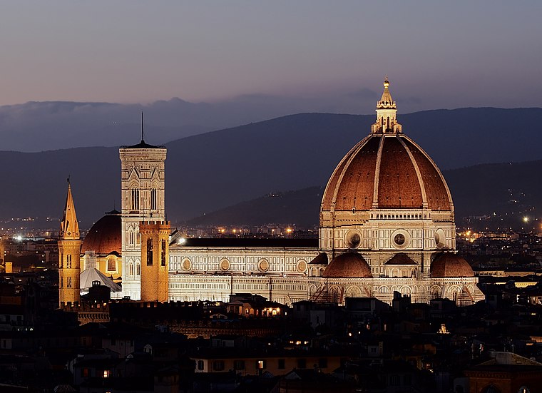
Photo: PetarM, CC BY-SA 4.0.
Florence Cathedral, formally the Cathedral of Saint Mary of the Flower, is the cathedral of the Catholic Archdiocese of Florence in Florence, Italy. Commenced in 1296 in the Gothic style to a design of Arnolfo di Cambio and completed by 1436 with a dome…
Places in the Area
Nearby places include Statuto and Coverciano.

Coverciano
Neighborhood
 Coverciano is a city quartiere in the southeastern part of Florence, Italy. The neighborhood is bordered by the Affrico and Mensola streams, by the slopes of the hills and by the Via Aretina.

Le Cure
- Type: Neighborhood
- Category: locality
- Location: Florence, Florence, Tuscany, Central Italy, Italy, Europe
- View on OpenStreetMap
Latitude
43.78702° or 43° 47′ 13″ northLongitude
11.26933° or 11° 16′ 10″ eastElevation
62 metres (203 feet)Open location code
8FMHQ7P9+RPOpenStreetMap ID
node 6139022220OpenStreetMap feature
place=neighbourhoodGeoNames ID
12023196
This page is based on OpenStreetMap, GeoNames, Wikidata, and Wikimedia Commons.
We’d love your help improving our open data sources. Thank you for contributing.
Satellite Map
Discover Le Cure from above in high-definition satellite imagery.
Localities in the Area
Explore places such as Campo di Marte and Il Cionfo.
Notable Places Nearby
Highlights include Piazza delle Cure and Mercato delle Cure.
Florence: Must-Visit Destinations
Delve into Scandicci, Fiesole, Greve in Chianti, and San Casciano in Val di Pesa.
Curious Places to Discover
Uncover intriguing places from every corner of the globe.
About Mapcarta. Data © OpenStreetMap contributors and available under the Open Database License". Text is available under the CC BY-SA 4.0 license, except for photos, directions, and the map. Photo: Gary Ashley, CC BY 2.0.