Getränke Wiggers
Getränke Wiggers is a beverage shop in Leutkirch im Allgäu, Ravensburg, Baden-Württemberg. Getränke Wiggers is situated nearby to the health club Card Studio, as well as near the railway station Leutkirch station.| Tap on a place to explore it |
Places of Interest Nearby
Highlights include Leutkirch station and Pulverturm.
Leutkirch station
Railway station
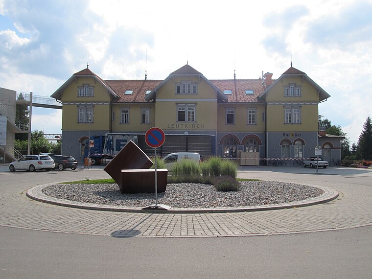
Photo: Lenni-2011, CC BY-SA 3.0.
Leutkirch station is the station of the town of Leutkirch im Allgäu in the German state of Baden-Württemberg. It is classified by Deutsche Bahn as a category 5 station and has two platform tracks. Leutkirch station is situated 270 metres east of Getränke Wiggers.
Pulverturm
Building
The Leutkirch Pulverturm or Leutkirch Powder Tower was built towards the end of the 17th century on the southeast corner of Leutkirch im Allgäu, Baden-Württemberg, Germany, as part of the rebuilding of the collapsed town wall. Pulverturm is situated 1 km east of Getränke Wiggers.
Château Hummelsberg
Building

Photo: Richard Mayer, CC BY-SA 3.0.
Château Hummelsberg is a building, which is situated 1¼ km east of Getränke Wiggers.
Places in the Area
Nearby places include Tautenhofen and Herlazhofen.

Herlazhofen
Village

Photo: Richard Mayer, CC BY-SA 3.0.
Herlazhofen is a village in the South-German region Allgäu. It is part of the town Leutkirch im Allgäu. The population is approximately 1000 inhabitants. Herlazhofen is situated 3½ km south of Getränke Wiggers.
Unterzeil
Village

Photo: Richard Mayer, CC BY 3.0.
Unterzeil is a village, which is situated 4 km north of Getränke Wiggers.
Getränke Wiggers
- Opening hours:
Monday—Friday: 9:00 AM—noon and 2:00 PM—6:00 PM
Saturday: 8:30 AM—12:30 PM - Type: Beverage shop
- Category: shop
- Location: Leutkirch im Allgäu, Ravensburg, Tübingen Region, Baden-Württemberg, Germany, Central Europe, Europe
- View on OpenStreetMap
Latitude
47.82625° or 47° 49′ 35″ northLongitude
10.0126° or 10° 0′ 45″ eastOpen location code
8FVGR2G7+G2OpenStreetMap ID
node 6334233385OpenStreetMap feature
shop=beverages
This page is based on OpenStreetMap, Wikidata, and Wikimedia Commons.
We’d love your help improving our open data sources. Thank you for contributing.
Satellite Map
Discover Getränke Wiggers from above in high-definition satellite imagery.
Notable Places Nearby
Highlights include Card Studio and Bahnhofspark.
Nearby Places
Explore places such as EKL AG and Leutkirch Nadlerstraße / Stephanuswerk.
Baden-Württemberg: Must-Visit Destinations
Delve into Stuttgart, Heidelberg, Karlsruhe, and Mannheim.
Curious Beverage Shops to Discover
Uncover intriguing beverage shops from every corner of the globe.
About Mapcarta. Data © OpenStreetMap contributors and available under the Open Database License". Text is available under the CC BY-SA 4.0 license, except for photos, directions, and the map. Photo: Traveler100, CC BY-SA 3.0.