Zimmermanns Senf
Zimmermanns Senf is a shop in Niederfinow, Barnim, Brandenburg. Zimmermanns Senf is situated nearby to the tourism office Info-Zentrum altes SHW, as well as near the motorhome stopover Wohnmobilstellplatz Schiffshebewerk Niederfinow.| Tap on a place to explore it |
Places of Interest Nearby
Highlights include Niederfinow Boat Lift and Village church Niederfinow.
Niederfinow Boat Lift
 The Niederfinow Boat Lift is the oldest working boat lift in Germany. It lies on the Oder-Havel Canal near Niederfinow in Brandenburg. The lift overcomes a difference in elevation of 36 metres. Niederfinow Boat Lift is situated 440 metres northeast of Zimmermanns Senf.
Village church Niederfinow
Church
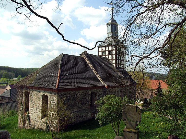
Photo: Ralf Roletschek, GFDL.
Village church Niederfinow is situated 1½ km southwest of Zimmermanns Senf.
Niederfinow station
Railway station

Photo: Ralf Roletschek, GFDL.
Niederfinow station is a railway station in the municipality of Niederfinow, located in the Barnim district in Brandenburg, Germany. Niederfinow station is situated 2 km southwest of Zimmermanns Senf.
Places in the Area
Nearby places include Liepe and Hohenfinow.
Liepe
Village

Photo: Ralf Roletschek, CC BY-SA 2.0 de.
Liepe is a municipality in the district of Barnim in Brandenburg in Germany. Liepe is situated 3 km northeast of Zimmermanns Senf.
Hohenfinow
Village

Photo: Hans G. Oberlack, CC BY-SA 4.0.
Hohenfinow is a municipality in the Barnim district in Brandenburg, Germany. It is part of the Amt Amt Britz-Chorin-Oderberg. Hohenfinow is situated 4 km south of Zimmermanns Senf.
Tornow
Village
Photo: Hans G. Oberlack, CC BY-SA 4.0.
Tornow is a village, which is situated 4½ km southwest of Zimmermanns Senf.
Zimmermanns Senf
- Type: Shop
- Location: Niederfinow, Barnim, Brandenburg, Germany, Central Europe, Europe
- View on OpenStreetMap
Latitude
52.84554° or 52° 50′ 44″ northLongitude
13.9389° or 13° 56′ 20″ eastOperator
Rainer ZimmermannOpen location code
9F4MRWWQ+6HOpenStreetMap ID
node 6337354201OpenStreetMap feature
shop=yes
This page is based on OpenStreetMap, Wikidata, and Wikimedia Commons.
We’d love your help improving our open data sources. Thank you for contributing.
Satellite Map
Discover Zimmermanns Senf from above in high-definition satellite imagery.
Notable Places Nearby
Highlights include Info-Zentrum altes SHW and Wohnmobilstellplatz Schiffshebewerk Niederfinow.
Nearby Places
Explore places such as Niederfinow, Schiffshebewerk and Am Schiffshebewerk.
Brandenburg: Must-Visit Destinations
Delve into Potsdam, Cottbus, Frankfurt an der Oder, and Brandenburg an der Havel.
Curious Shops to Discover
Uncover intriguing shops from every corner of the globe.
About Mapcarta. Data © OpenStreetMap contributors and available under the Open Database License". Text is available under the CC BY-SA 4.0 license, except for photos, directions, and the map. Photo: Leviathan1983, CC BY-SA 3.0.