tienda Mary, Es la Cetino
tienda Mary, Es la Cetino is a convenience store in Puerto Barrios, Izabal Department. tienda Mary, Es la Cetino is situated nearby to the marketplace Mercado Municipal, as well as near the bus station Litegua.| Tap on a place to explore it |
Places of Interest Nearby
Highlights include Puerto Barrios Airport.
Puerto Barrios Airport
Aerodrome
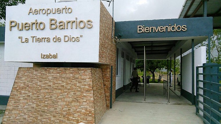
Photo: EduardoEmilio1, CC BY-SA 4.0.
Puerto Barrios Airport, formerly Izabal Air Base, serves the city of Puerto Barrios, the port of Santo Tomás de Castilla and the Guatemalan Caribbean. It is operated and administrated by Dirección General de Aeronáutica Civil.
Places in the Area
Nearby places include Santo Tomás de Castilla.
Santo Tomás de Castilla
Town

Photo: Wikimedia, CC BY-SA 2.0.
Santo Tomás de Castilla, officially known as Mátías de Gálvez though it popularly retains its former name, is a port city in the Izabal Department, Guatemala. It lies at Amatique Bay off the Gulf of Honduras and is administratively a part of Puerto Barrios. Santo Tomás de Castilla is situated 5 km south of tienda Mary, Es la Cetino.
tienda Mary, Es la Cetino
- Type: Convenience store
- Categories: shop and food
- Location: Puerto Barrios, Izabal Department, Caribbean Coast, Guatemala, Central America, North America
- View on OpenStreetMap
Latitude
15.73269° or 15° 43′ 58″ northLongitude
-88.59868° or 88° 35′ 55″ westOpen location code
767HPCM2+3GOpenStreetMap ID
node 6352695788OpenStreetMap feature
shop=convenience
This page is based on OpenStreetMap, Wikidata, and Wikimedia Commons.
We’d love your help improving our open data sources. Thank you for contributing.
Satellite Map
Discover tienda Mary, Es la Cetino from above in high-definition satellite imagery.
Notable Places Nearby
Highlights include Mercado Municipal and Litegua.
Nearby Places
Explore places such as Hotel Xelaju and luis agustin, refresqueria noraldina.
Curious Convenience Stores to Discover
Uncover intriguing convenience stores from every corner of the globe.
About Mapcarta. Data © OpenStreetMap contributors and available under the Open Database License". Text is available under the CC BY-SA 4.0 license, except for photos, directions, and the map. Photo: Wikimedia, CC BY-SA 2.0.