Árnyas Kert
Árnyas Kert is a garden in Pest County, Central Hungary. Árnyas Kert is situated nearby to the sports venue MEGAFitness, as well as near BMSZC Trefort Ágoston Bilingual Technical High School.| Tap on a place to explore it |
Places of Interest Nearby
Highlights include Kőbánya-Kispest metro station and BMSZC Trefort Ágoston Bilingual Technical High School.
Kőbánya-Kispest metro station
Metro station
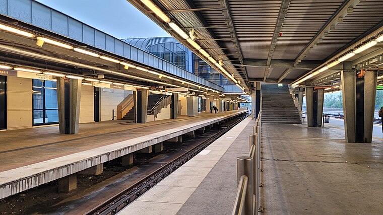
Photo: Bilykralik16, CC BY-SA 4.0.
Kőbánya-Kispest is the southern terminus of the M3 Line of the Budapest Metro. It is the only station of the line that is above ground. The station was opened on 20 April 1980 as part of the extension from Nagyvárad tér. Kőbánya-Kispest metro station is situated 310 metres northeast of Árnyas Kert.
BMSZC Trefort Ágoston Bilingual Technical High School
School

Photo: Oppashi, CC BY-SA 3.0.
BMSZC Trefort Ágoston Bilingual Technical High School is situated 150 metres south of Árnyas Kert.
Kispesti Helytörténeti Gyűjtemény
Museum

Photo: Misibacsi, CC BY-SA 3.0.
Kispesti Helytörténeti Gyűjtemény is a museum, which is situated 520 metres southeast of Árnyas Kert.
Places in the Area
Nearby places include Wekerletelep and Kőbánya.
Wekerletelep
Suburb
The Wekerle estate is a part of Budapest's XIX. district. Kispest, formerly a suburb was administratively attached to Budapest in 1950 along with several other settlements of Greater Budapest.
Kőbánya

Photo: László Eisenbacher, CC BY 3.0.
Kőbánya is the official name of the 10th district of Budapest. In the north-west corner is a large public park called Népliget.
MÁV-telep
Neighborhood

Photo: Globetrotter19, CC BY-SA 3.0.
MÁV-telep is a neighborhood, which is situated 4 km northwest of Árnyas Kert.
Árnyas Kert
- Type: Garden
- Category: recreation area
- Location: Pest County, Central Hungary, Hungary, Central Europe, Europe
- View on OpenStreetMap
Latitude
47.46149° or 47° 27′ 41″ northLongitude
19.14549° or 19° 8′ 44″ eastInception
2015Operator
Városi Kertek EgyesületOpen location code
8FVXF46W+H5OpenStreetMap ID
node 6354188919OpenStreetMap feature
leisure=garden
This page is based on OpenStreetMap, Wikidata, and Wikimedia Commons.
We’d love your help improving our open data sources. Thank you for contributing.
Satellite Map
Discover Árnyas Kert from above in high-definition satellite imagery.
Notable Places Nearby
Highlights include MEGAFitness and R-26S Góbé vitorlázó repülőgép.
Nearby Places
Explore places such as Tesco and Kispesti Eötvös József Általános Iskola.
Pest County: Must-Visit Destinations
Delve into Érd, Cegléd, Gödöllő, and Budaörs.
Curious Gardens to Discover
Uncover intriguing gardens from every corner of the globe.
About Mapcarta. Data © OpenStreetMap contributors and available under the Open Database License". Text is available under the CC BY-SA 4.0 license, except for photos, directions, and the map. Photo: ucsendre, CC BY-SA 3.0.