Kala
Kala is a locality in Williamson, Texas. Kala is situated nearby to the neighborhood Berry Springs, as well as near Stillwater.| Tap on a place to explore it |
Places of Interest
Highlights include Weir Cemetery and East View High School.
Weir Cemetery
Cemetery
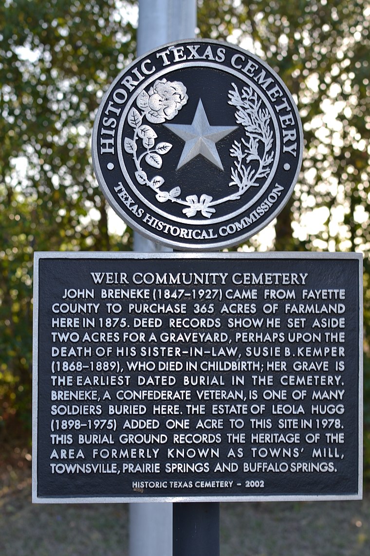
Photo: Carbs1992, CC BY-SA 3.0.
Weir Cemetery is situated 2½ miles east of Kala.
East View High School
School
East View High School is a UIL 5A public high school located in Georgetown, Texas, United States. It is part of the Georgetown Independent School District located in central Williamson County. East View High School is situated 2 miles south of Kala.
Places in the Area
Nearby places include Weir and Georgetown.
Weir
Village
Weir is a city in Williamson County, Texas, United States. The population was 699 at the 2020 census. Weir is situated 2 miles east of Kala.
Georgetown

Photo: Austex, CC BY-SA 3.0.
Georgetown is a city in Texas and the county seat of Williamson County, Texas, United States. The population was 67,176 at the 2020 census, and according to 2024 census estimates, the city is estimated to have a population of 101,344.
Walburg
Hamlet
Walburg, originally called Concordia, is an unincorporated area located at the crossroads of Farm to Market Road 972 and Farm to Market Road 1105 in Williamson County, Texas, United States, thirty-three miles northeast of Austin. Walburg is situated 5 miles northeast of Kala.
Kala
- Type: Locality
- Location: Williamson, Texas, United States, North America
- View on OpenStreetMap
Latitude
30.6718° or 30° 40′ 19″ northLongitude
-97.62012° or 97° 37′ 12″ westOpen location code
8624M9CH+PXOpenStreetMap ID
node 6379729177OpenStreetMap feature
place=locality
This page is based on OpenStreetMap, Wikidata, and Wikimedia Commons.
We’d love your help improving our open data sources. Thank you for contributing.
Satellite Map
Discover Kala from above in high-definition satellite imagery.
Places with the Same Name
Discover other places named “Kala”.
Localities in the Area
Explore places such as Berry Springs and Stillwater.
Notable Places Nearby
Highlights include Diaz’s Food Truck and Bar 3 Ranch Airport.
Texas: Must-Visit Destinations
Delve into Houston, Austin, Dallas, and San Antonio.
Curious Localities to Discover
Uncover intriguing localities from every corner of the globe.
About Mapcarta. Data © OpenStreetMap contributors and available under the Open Database License". Text is available under the CC BY-SA 4.0 license, except for photos, directions, and the map. Photo: Wikimedia, CC0.