Pesqueiro da Senhora da Cabeça
Pesqueiro da Senhora da Cabeça is a fishing area in Valença, Cristelo Covo e Arão, Valença, Viana do Castelo District. Pesqueiro da Senhora da Cabeça is situated nearby to the marina Cais da Senhora da Cabeça, as well as near the playground Parque Infantil da Senhora da Cabeça.| Tap on a place to explore it |
Places of Interest Nearby
Highlights include Fortificações da Praça de Valença do Minho and Câmara Municipal de Valença.
Fortificações da Praça de Valença do Minho
Historic site
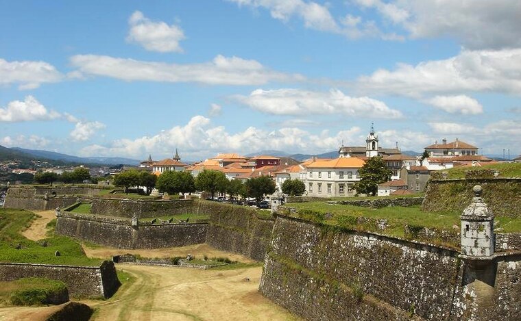
Photo: PQ3, CC BY-SA 3.0.
Fortificações da Praça de Valença do Minho is a historic site, which is situated 1¼ km northeast of Pesqueiro da Senhora da Cabeça.
Câmara Municipal de Valença
Town hall
 Câmara Municipal de Valença is a town hall, which is situated 1¼ km northeast of Pesqueiro da Senhora da Cabeça.
Pelourinho de Valença

Photo: Daniel VILLAFRUELA, CC BY-SA 4.0.
Pelourinho de Valença is situated 1¼ km northeast of Pesqueiro da Senhora da Cabeça.
Places in the Area
Nearby places include Tui and São Pedro da Torre.
Tui

Photo: Lmbuga, CC BY-SA 2.5 es.
Tui is a town in Galicia on the north bank of the Miño River, on the border with Portugal. In Castilian Spanish it's "Tuy" but Galician place names are now the official version.
São Pedro da Torre
Village

Photo: Reis Quarteu, CC BY-SA 4.0.
São Pedro da Torre is a Portuguese civil “parish”, located in the municipality of Valença. The population in 2011 was 1,267, in an area of 7.79 km2. São Pedro da Torre is situated 4 km south of Pesqueiro da Senhora da Cabeça.
San Bartolomeu
Hamlet

Photo: Wikimedia, CC BY-SA 4.0.
San Bartolomeu is a hamlet, which is situated 4 km northeast of Pesqueiro da Senhora da Cabeça.
Pesqueiro da Senhora da Cabeça
- Type: Fishing area
- Categories: recreation area and sports location
- Location: Valença, Cristelo Covo e Arão, Valença, Viana do Castelo District, Portugal, Iberia, Europe
- View on OpenStreetMap
Latitude
42.02447° or 42° 1′ 28″ northLongitude
-8.65782° or 8° 39′ 28″ westOpen location code
8CJH28FR+QVOpenStreetMap ID
node 6384436156OpenStreetMap feature
leisure=fishing
This page is based on OpenStreetMap, Wikidata, and Wikimedia Commons.
We’d love your help improving our open data sources. Thank you for contributing.
Satellite Map
Discover Pesqueiro da Senhora da Cabeça from above in high-definition satellite imagery.
Notable Places Nearby
Highlights include Cais da Senhora da Cabeça and Parque Infantil da Senhora da Cabeça.
Nearby Places
Explore places such as Nautico and Senhora da Cabeça.
Portugal: Must-Visit Destinations
Delve into Lisbon, Caldas da Rainha, Porto, and Coimbra.
Curious Fishing Areas to Discover
Uncover intriguing fishing areas from every corner of the globe.
About Mapcarta. Data © OpenStreetMap contributors and available under the Open Database License". Text is available under the CC BY-SA 4.0 license, except for photos, directions, and the map. Photo: Sergei Gussev, CC BY 2.0.