The Strength Clinic
The Strength Clinic is a health club in Alcântara, Lisbon which is located on Rua dos Lusíadas. The Strength Clinic is situated nearby to the post office CTT, as well as near the town hall Junta de Freguesia de Alcântara.| Tap on a place to explore it |
- Opening hours: Monday—Friday 7:00 AM—9:00 PM and Saturday 9:00 AM—noon
- Email: info@thestrengthclinic.training
- Type: Health club
- Address: A, Rua dos Lusíadas 38, Lisboa, 1300-371
Places of Interest Nearby
Highlights include Edifício da antiga Escola Industrial do Marquês de Pombal, actualmente Escola Secundária de Fonseca Benevides and Church of São Pedro em Alcântara.
Edifício da antiga Escola Industrial do Marquês de Pombal, actualmente Escola Secundária de Fonseca Benevides
College

Photo: GualdimG, CC BY-SA 4.0.
Edifício da antiga Escola Industrial do Marquês de Pombal, actualmente Escola Secundária de Fonseca Benevides is a college, which is situated 160 metres east of The Strength Clinic.
Church of São Pedro em Alcântara
Church

Photo: GualdimG, CC BY-SA 4.0.
Church of São Pedro em Alcântara is situated 220 metres east of The Strength Clinic.
Alcântara-Terra railway station
Railway station
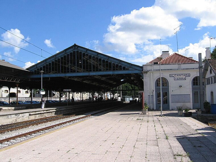
Photo: Manuel Correia, Public domain.
Alcântara-Terra railway station, is a railway station on the Cintura Line in the city of Lisbon, Portugal. The station is connected by foot to Alcântara-Mar railway station on the Cascais Line. Alcântara-Terra railway station is situated 490 metres east of The Strength Clinic.
Places in the Area
Nearby places include Campo de Ourique and Parque Infantil do Alvito.
Campo de Ourique
Village
 Campo de Ourique is a freguesia and district of Lisbon, the capital of Portugal. Camp de Ourique is located in the historic center of Lisbon, east of Alcântara, north of Estrela, west of Santo António, and south of Campolide. The population in 2011 was 22,120.
Parque Infantil do Alvito
Locality

Photo: CorreiaPM, Public domain.
Parque Infantil do Alvito is a locality.
Estrela
Village

Photo: scalleja, CC BY-SA 2.0.
Estrela is a freguesia and district of Lisbon, the capital of Portugal. Located in the historic center of Lisbon, Estrela is south of Campo de Ourique, west of Misericórdia, and east of Alcântara.
The Strength Clinic
- Categories: athletics, recreation area, and sports location
- Location: Alcântara, Lisbon, Lisbon District, Portugal, Iberia, Europe
- View on OpenStreetMap
Latitude
38.70581° or 38° 42′ 21″ northLongitude
-9.17851° or 9° 10′ 43″ westOpen location code
8CCGPR4C+8HOpenStreetMap ID
node 6385068142OpenStreetMap feature
leisure=fitness_centreOpenStreetMap feature
sport=athletics
This page is based on OpenStreetMap, Wikidata, and Wikimedia Commons.
We’d love your help improving our open data sources. Thank you for contributing.
Satellite Map
Discover The Strength Clinic from above in high-definition satellite imagery.
Notable Places Nearby
Highlights include CTT and Junta de Freguesia de Alcântara.
Nearby Places
Explore places such as Farmácia Alquimista and Rua dos Lusíadas / Rua Leão de Oliveira.
Lisbon: Must-Visit Destinations
Delve into Bairro Alto, Alfama, Baixa, and Belém.
Curious Health Clubs to Discover
Uncover intriguing health clubs from every corner of the globe.
About Mapcarta. Data © OpenStreetMap contributors and available under the Open Database License". Text is available under the CC BY-SA 4.0 license, except for photos, directions, and the map. Photo: Alvesgaspar, CC BY-SA 3.0.