Fähre Hitzacker (Elbe)-Bitter
Fähre Hitzacker (Elbe)-Bitter is a passenger ship terminal in Germany. Fähre Hitzacker (Elbe)-Bitter is situated nearby to the peak Weinberg, as well as near the square Karl-Guhl-Platz.| Tap on a place to explore it |
Places of Interest Nearby
Highlights include St.-Johannis-Kirche and Oktogon.
St.-Johannis-Kirche
Church

Photo: Fice, CC BY-SA 3.0.
St.-Johannis-Kirche is a church, which is situated 670 metres southeast of Fähre Hitzacker (Elbe)-Bitter.
Oktogon
Church

Photo: Fice, CC BY-SA 3.0.
Oktogon is a church, which is situated 760 metres south of Fähre Hitzacker (Elbe)-Bitter.
Hitzacker Archaeological Centre
Museum
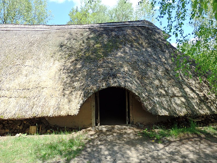
Photo: Wikimedia, CC BY-SA 3.0.
The Hitzacker Archaeological Centre is an archaeological open-air museum in Hitzacker in the German state of Lower Saxony. The core theme of the museum is the presentation of Bronze Age settlements. Hitzacker Archaeological Centre is situated 1¼ km south of Fähre Hitzacker (Elbe)-Bitter.
Places in the Area
Nearby places include Hitzacker and Nienwedel.
Hitzacker

Photo: Torsten Bätge, CC BY-SA 3.0.
Hitzacker is a charming riverside town of 5,000 peoole in Lüchow-Dannenberg district in the Lüneburg Heath region of North Germany. It lies on the River Elbe, about 45 km east of Lüneburg on a tourist route, the German Timber-Frame Road.
Nienwedel
Hamlet

Photo: Fice, CC BY-SA 3.0.
Nienwedel is a hamlet, which is situated 3 km southeast of Fähre Hitzacker (Elbe)-Bitter.
Sarchem
Hamlet

Photo: Fice, CC BY-SA 4.0.
Sarchem is a hamlet, which is situated 3 km west of Fähre Hitzacker (Elbe)-Bitter.
Fähre Hitzacker (Elbe)-Bitter
- Type: Passenger ship terminal
- Wheelchair access: limited
- Category: transportation
- Location: Germany, Central Europe, Europe
- View on OpenStreetMap
Latitude
53.15722° or 53° 9′ 26″ northLongitude
11.04463° or 11° 2′ 41″ eastOpen location code
9F5H524V+VROpenStreetMap ID
node 6390413189OpenStreetMap feature
amenity=ferry_terminalOpenStreetMap attribute
wheelchair=limited
This page is based on OpenStreetMap, Wikidata, and Wikimedia Commons.
We’d love your help improving our open data sources. Thank you for contributing.
Satellite Map
Discover Fähre Hitzacker (Elbe)-Bitter from above in high-definition satellite imagery.
Notable Places Nearby
Highlights include Weinberg and Karl-Guhl-Platz.
Nearby Places
Explore places such as Sielgebäude Ost and Sielgebäude West.
Germany: Must-Visit Destinations
Delve into Berlin, Munich, Hamburg, and Frankfurt.
Curious Passenger Ship Terminals to Discover
Uncover intriguing passenger ship terminals from every corner of the globe.
About Mapcarta. Data © OpenStreetMap contributors and available under the Open Database License". Text is available under the CC BY-SA 4.0 license, except for photos, directions, and the map. Photo: Taxiarchos228, FAL.