Pastelería Gernika
Pastelería Gernika is a bakery in Barakaldo, Biscay, Basque Country. Pastelería Gernika is situated nearby to the metro station Bagatza, as well as near the bus stop Santa Teresa (370).| Tap on a place to explore it |
Places of Interest Nearby
Highlights include Bagatza and San Eloy Hopsital.
Bagatza
Metro station

Photo: Ardo Beltz, CC BY-SA 3.0.
Bagatza is a station on line 2 of the Bilbao metro. It is located in the neighborhood of Santa Teresa, in the municipality of Barakaldo, in close proximity to San Eloy Hospital and the music conservatory. It opened on 13 April 2002.
San Eloy Hopsital
Hospital
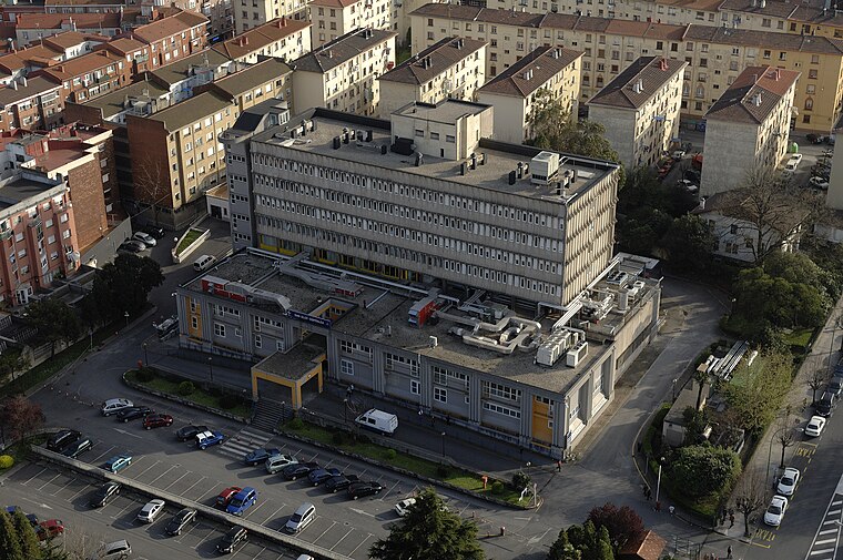
Photo: Wikimedia, CC BY-SA 3.0.
San Eloy Hopsital is a hospital, which is situated 240 metres southwest of Pastelería Gernika.
Fronton
Pitch

Photo: Ondare Lagunak, CC BY-SA 3.0.
Fronton is a pitch, which is situated 220 metres southeast of Pastelería Gernika.
Places in the Area
Nearby places include Santa Teresa-Beurko and Beurko.
Santa Teresa-Beurko
Neighborhood

Photo: Vanbasten 23, CC BY-SA 3.0.
Santa Teresa-Beurko is a neighborhood.


Pastelería Gernika
- Type: Bakery
- Categories: shop and food
- Location: Barakaldo, Biscay, Basque Country, Northern Spain, Spain, Iberia, Europe
- View on OpenStreetMap
Latitude
43.29865° or 43° 17′ 55″ northLongitude
-2.99229° or 2° 59′ 32″ westOpen location code
8CMV72X5+F3OpenStreetMap ID
node 6392300185OpenStreetMap feature
shop=bakery
This page is based on OpenStreetMap, Wikidata, and Wikimedia Commons.
We’d love your help improving our open data sources. Thank you for contributing.
Satellite Map
Discover Pastelería Gernika from above in high-definition satellite imagery.
Notable Places Nearby
Highlights include Santa Teresa (370) and Mercado de Santa Teresa.
Nearby Places
Explore places such as Rodríguez and Diseño Joya.
Basque Country: Must-Visit Destinations
Delve into Bilbao, San Sebastián, Vitoria-Gasteiz, and Guernica.
Curious Bakeries to Discover
Uncover intriguing bakeries from every corner of the globe.
About Mapcarta. Data © OpenStreetMap contributors and available under the Open Database License". Text is available under the CC BY-SA 4.0 license, except for photos, directions, and the map. Photo: Ander Abadia Zallo, CC BY 4.0.