Son Durak Lüdenscheid
Son Durak Lüdenscheid is a fast food restaurant in Lüdenscheid, Märkischer Kreis, North Rhine-Westphalia which is located on Kluser Straße. Son Durak Lüdenscheid is situated nearby to the community center Vereinshaus Immanuel, as well as near the playground Spielplatz Kluser Platz.| Tap on a place to explore it |
- Opening hours:
Monday: closed
Tuesday—Saturday: 9:00 AM—11:00 PM
Sunday: 10:00 AM—11:00 PM - Type: Fast food restaurant
- Cuisine: Turkish
- Also known as: “Emmoğlu Taşfırın”
- Address: Kluser Straße 15, Lüdenscheid, 58511
Places of Interest Nearby
Highlights include Lüdenscheid City Library and Erlöserkirche (Lüdenscheid).
Lüdenscheid City Library
Library

Photo: Wikimedia, CC BY-SA 3.0.
Lüdenscheid City Library is situated 460 metres southwest of Son Durak Lüdenscheid.
Erlöserkirche (Lüdenscheid)
Church

Photo: Silvercork, CC BY-SA 3.0.
Erlöserkirche (Lüdenscheid) is a church, which is situated 530 metres southwest of Son Durak Lüdenscheid.
Kulturhaus Lüdenscheid
Theater building
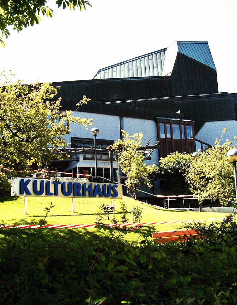
Photo: Silvercork, CC BY-SA 3.0.
Kulturhaus Lüdenscheid is a theatre in Ludenscheid, North Rhine-Westphalia, Germany. Kulturhaus Lüdenscheid is situated 730 metres southwest of Son Durak Lüdenscheid.
Places in the Area
Nearby places include Kalve and Heedfeld.

Heedfeld
Village

Photo: Mich.kramer, CC BY-SA 3.0.
Heedfeld is a village, which is situated 6 km northwest of Son Durak Lüdenscheid.
Oberbrügge
Suburb

Photo: Mich.kramer, CC BY-SA 3.0.
Oberbrügge is a suburb, which is situated 6 km southwest of Son Durak Lüdenscheid.
Son Durak Lüdenscheid
- Categories: food and restaurant
- Location: Lüdenscheid, Märkischer Kreis, Arnsberg, South Westphalia, North Rhine-Westphalia, Germany, Central Europe, Europe
- View on OpenStreetMap
Latitude
51.21941° or 51° 13′ 10″ northLongitude
7.63913° or 7° 38′ 21″ eastOpen location code
9F396J9Q+QMOpenStreetMap ID
node 6393290882OpenStreetMap feature
amenity=fast_foodOpenStreetMap attribute
cuisine=turkish
This page is based on OpenStreetMap, Wikidata, and Wikimedia Commons.
We’d love your help improving our open data sources. Thank you for contributing.
Satellite Map
Discover Son Durak Lüdenscheid from above in high-definition satellite imagery.
Notable Places Nearby
Highlights include Vereinshaus Immanuel and Spielplatz Kluser Platz.
Nearby Places
Explore places such as Kasap 76 and Cafe Jiamas.
South Westphalia: Must-Visit Destinations
Delve into Siegen, Iserlohn, Soest, and Schmallenberg.
Curious Fast Food Restaurants to Discover
Uncover intriguing fast food restaurants from every corner of the globe.
About Mapcarta. Data © OpenStreetMap contributors and available under the Open Database License". Text is available under the CC BY-SA 4.0 license, except for photos, directions, and the map. Photo: Wikimedia, CC0.