Omari Ally Juma Primary School
Omari Ally Juma Primary School is a school in Makurumla, Kinondoni Municipal Council, Dar es Salaam Region. Omari Ally Juma Primary School is situated nearby to the cemetery Karume, as well as near the government office CCM Office.| Tap on a place to explore it |
Places of Interest Nearby
Highlights include Muhimbili National Hospital and Embassy of Russia, Dar es Salaam.
Muhimbili National Hospital
Hospital
Muhimbili National Hospital is a 1500-bed public teaching hospital located in Upanga West ward of Ilala District in Dar es Salaam Region of Tanzania. It is the national referral hospital as well as academic and research facility for the Muhimbili University of Health and Allied Sciences. Muhimbili National Hospital is situated 2½ km east of Omari Ally Juma Primary School.
Embassy of Russia, Dar es Salaam
Government office

Photo: Wikimedia, CC BY-SA 2.0.
Embassy of Russia, Dar es Salaam is a government office, which is situated 3½ km northeast of Omari Ally Juma Primary School.
Embassy of France, Dar es Salaam
Government office
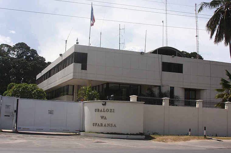
Photo: clarkarrington, CC BY 2.0.
Embassy of France, Dar es Salaam is a government office, which is situated 3½ km northeast of Omari Ally Juma Primary School.
Places in the Area
Nearby places include Mwananyamala and Dar es Salaam.
Mwananyamala
Locality
Mwananyamala is an administrative ward in Kinondoni District of the Dar es Salaam Region in Tanzania. The ward is bordered to the north by Mikocheni ward and to the east by Msasani and Kinondoni.
Dar es Salaam

Photo: Roland, CC BY-SA 2.0.
Dar es Salaam was founded in 1862 by Sultan Seyyid Majid of Zanzibar on the site of the village of Mzizima. Mzizima's history dates back to when the Barawa people started to settle and cultivate the area around Mbwa Maji, Magogoni, Mjimwema, Gezaulole, and Kibonde Maji Mbagara.
Omari Ally Juma Primary School
- Type: School
- Address: Dar es salaam, Ubungo, Ubungo
- Category: education
- Location: Makurumla, Kinondoni Municipal Council, Dar es Salaam Region, Tanzania, East Africa, Africa
- View on OpenStreetMap
Latitude
-6.80619° or 6° 48′ 22″ southLongitude
39.24968° or 39° 14′ 59″ eastOpen location code
6G5X56VX+GVOpenStreetMap ID
node 6400556004OpenStreetMap feature
amenity=school
This page is based on OpenStreetMap, Wikidata, and Wikimedia Commons.
We’d love your help improving our open data sources. Thank you for contributing.
Satellite Map
Discover Omari Ally Juma Primary School from above in high-definition satellite imagery.
Notable Places Nearby
Highlights include CCM Office and Karume.
Nearby Places
Explore places such as Omari Ally Juma Primary School and Karume Primary School.
Tanzania: Must-Visit Destinations
Delve into Dar es Salaam, Mount Kilimanjaro, Dodoma, and Arusha.
Curious Places to Discover
Uncover intriguing places from every corner of the globe.
About Mapcarta. Data © OpenStreetMap contributors and available under the Open Database License". Text is available under the CC BY-SA 4.0 license, except for photos, directions, and the map. Photo: Muhammad Mahdi Karim, GFDL.