Am Erbachhofer Fahrweg
Am Erbachhofer Fahrweg is a locality in Waiblingen, Rems-Murr-Kreis, Baden-Württemberg. Am Erbachhofer Fahrweg is situated nearby to the locality Waldäcker, as well as near Innere Allee.| Tap on a place to explore it |
Places of Interest
Highlights include Sörenberg and St. Maria.


Places in the Area
Nearby places include Erbachhof and Schwaikheim.

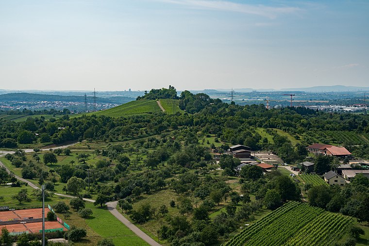
Schwaikheim
Village

Photo: Wikimedia, CC BY-SA 3.0.
Schwaikheim is a municipality in the district of Rems-Murr in Baden-Württemberg in Germany.

Am Erbachhofer Fahrweg
- Type: Locality
- Location: Waiblingen, Rems-Murr-Kreis, Stuttgart, Stuttgart Region, Baden-Württemberg, Germany, Central Europe, Europe
- View on OpenStreetMap
Latitude
48.8595° or 48° 51′ 34″ northLongitude
9.3435° or 9° 20′ 37″ eastOpen location code
8FWFV85V+Q9OpenStreetMap ID
node 6411378652OpenStreetMap feature
place=locality
This page is based on OpenStreetMap, Wikidata, and Wikimedia Commons.
We’d love your help improving our open data sources. Thank you for contributing.
Satellite Map
Discover Am Erbachhofer Fahrweg from above in high-definition satellite imagery.
Localities in the Area
Explore places such as Waldäcker and Innere Allee.
Notable Places Nearby
Highlights include Grillstelle auf dem Sörenberg and Rastplatz Sörenberg.
Stuttgart Region: Must-Visit Destinations
Delve into Stuttgart, Ludwigsburg, Esslingen, and Sindelfingen.
Curious Localities to Discover
Uncover intriguing localities from every corner of the globe.
About Mapcarta. Data © OpenStreetMap contributors and available under the Open Database License". Text is available under the CC BY-SA 4.0 license, except for photos, directions, and the map. Photo: Wikimedia, CC BY-SA 4.0.