Roque las Cabezadas
Roque las Cabezadas is a peak in Santa Cruz de Tenerife, Tenerife and has an elevation of 524 metres. Roque las Cabezadas is situated nearby to the neighborhood Puente de Hierro Alto, as well as near Cueva Prieta.| Tap on a place to explore it |
Places of Interest
Highlights include Masonic Temple of Santa Cruz de Tenerife and Estadio Heliodoro Rodríguez López.
Masonic Temple of Santa Cruz de Tenerife
Historic building
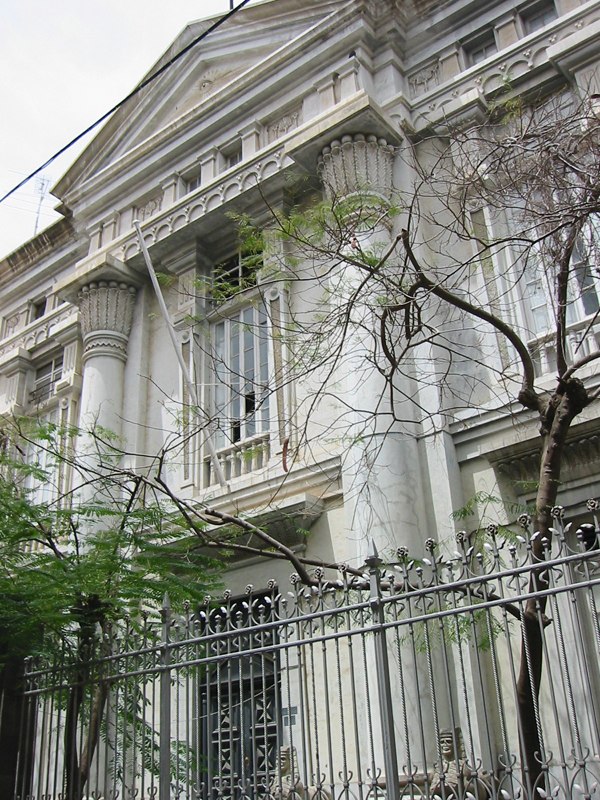
Photo: Jose Mesa, CC BY-SA 2.0.
The Historic Masonic Temple of Santa Cruz de Tenerife is a Masonic Temple located in the city of Santa Cruz de Tenerife, on Calle San Lucas. The building was constructed for use by the Añaza Lodge between 1899 and 1902.
Estadio Heliodoro Rodríguez López
Stadium

Photo: Edub, CC BY-SA 2.0.
Estadio Heliodoro Rodriguez Lopez also Estadio de Tenerife is a football stadium in Santa Cruz de Tenerife, Tenerife, Canary Islands, Spain. It is the home ground of CD Tenerife.
Parque García Sanabria
Park

Photo: Martely, Public domain.
Parque García Sanabria is a public urban park in the heart of Santa Cruz de Tenerife in Tenerife. It was inaugurated in 1926. It is a large garden area, combined with fountains and architectural groups.
Places in the Area
Nearby places include San Cristóbal de La Laguna and Anaga Rural Park.
San Cristóbal de La Laguna

Photo: Der Wolf im Wald, CC BY-SA 3.0.
San Cristóbal de La Laguna, informally known as La Laguna, is a city in Tenerife. It is the oldest city on the island and has a well-preserved city centre, and in 1999 was designated a UNESCO World Heritage Site.
Anaga Rural Park

Photo: Wikimedia, CC BY-SA 4.0.
The Anaga Rural Park is a national park covering most of the Anaga Massif in the northeast of the island Tenerife, the largest of the Canary Islands. The Anaga Rural Park is the second most important natural heritage site of Tenerife, after the Teide National Park.

Roque las Cabezadas
- Type: Peak with an elevation of 524 metres
- Category: landform
- Location: Santa Cruz de Tenerife, Santa Cruz de Tenerife, Tenerife, Canary Islands, Spain, Iberia, Europe
- View on OpenStreetMap
Latitude
28.4929° or 28° 29′ 35″ northLongitude
-16.261° or 16° 15′ 40″ westElevation
524 metres (1,719 feet)Open location code
7CW5FPVQ+5HOpenStreetMap ID
node 647785449OpenStreetMap feature
natural=peak
This page is based on OpenStreetMap, Wikidata, and Wikimedia Commons.
We’d love your help improving our open data sources. Thank you for contributing.
Satellite Map
Discover Roque las Cabezadas from above in high-definition satellite imagery.
Localities in the Area
Explore places such as Puente de Hierro Alto and Cueva Prieta.
Notable Places Nearby
Highlights include Depósito Los Campitos Cabecera and Los Campitos Reservoir.
Tenerife: Must-Visit Destinations
Delve into San Cristóbal de La Laguna, Teide National Park, Puerto de la Cruz, and Candelaria.
Curious Peaks to Discover
Uncover intriguing peaks from every corner of the globe.
About Mapcarta. Data © OpenStreetMap contributors and available under the Open Database License". Text is available under the CC BY-SA 4.0 license, except for photos, directions, and the map. Photo: Wikimedia, CC BY-SA 3.0.