Schlatt (Hohenzollern)
Schlatt (Hohenzollern) is a railway stop in Hechingen, Zollernalbkreis, Baden-Württemberg. Schlatt (Hohenzollern) is situated nearby to Schlatt (Hohenz) railway stop, as well as near the playground Saichlinger Spielplatz.| Tap on a place to explore it |
Places of Interest Nearby
Highlights include Schlatt (Hohenz) railway stop and Beurener Heide.

Beurener Heide
Nature reserve

Photo: Tintenklecks, CC BY-SA 3.0.
Beurener Heide is a nature reserve, which is situated 2½ km northeast of Schlatt (Hohenzollern).
Dreifürstenstein
Peak

Photo: Ramessos, Public domain.
Dreifürstenstein is a mountain in Zollernalbkreis, Baden-Württemberg, Germany. Dreifürstenstein is situated 3½ km northeast of Schlatt (Hohenzollern).
Places in the Area
Nearby places include Jungingen and Zimmern.
Jungingen
Village
 Jungingen is a municipality in the Zollernalbkreis, Baden-Württemberg, Germany. It is located nearby the castle Burg Hohenzollern, about 5 km east of Hechingen.
Zimmern
Village

Photo: Zollernalb, CC BY 2.5.
Zimmern is a village, which is situated 6 km southwest of Schlatt (Hohenzollern).
Bodelshausen
Village
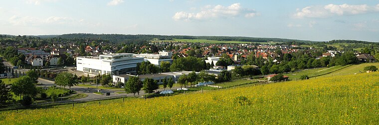
Photo: UnreifeKirsche, CC BY-SA 3.0.
Bodelshausen is a municipality in the district of Tübingen in the German state of Baden-Württemberg. Bodelshausen is situated 7 km northwest of Schlatt (Hohenzollern).
Schlatt (Hohenzollern)
- Type: Railway stop
- Categories: transport stop and transportation
- Location: Hechingen, Zollernalbkreis, Tübingen Region, Baden-Württemberg, Germany, Central Europe, Europe
- View on OpenStreetMap
Latitude
48.34355° or 48° 20′ 37″ northLongitude
9.02491° or 9° 1′ 30″ eastOperator
SWEG Schienenwege GmbHNetwork
Verkehrsverbund Neckar-Alb-DonauOpen location code
8FWF82VF+CXOpenStreetMap ID
node 6511152788OpenStreetMap feature
public_transport=stop_positionOpenStreetMap feature
railway=stop
This page is based on OpenStreetMap, Wikidata, and Wikimedia Commons.
We’d love your help improving our open data sources. Thank you for contributing.
Satellite Map
Discover Schlatt (Hohenzollern) from above in high-definition satellite imagery.
Notable Places Nearby
Highlights include Saichlinger Spielplatz and Pfarrkirche.
Nearby Places
Explore places such as Schlatt Bahnhof and Schlatt B32.
Baden-Württemberg: Must-Visit Destinations
Delve into Stuttgart, Heidelberg, Karlsruhe, and Mannheim.
Curious Railway Stops to Discover
Uncover intriguing railway stops from every corner of the globe.
About Mapcarta. Data © OpenStreetMap contributors and available under the Open Database License". Text is available under the CC BY-SA 4.0 license, except for photos, directions, and the map. Photo: Traveler100, CC BY-SA 3.0.