Oberhof
Oberhof is a village in Gießen, Giessen, Hesse. Oberhof is situated nearby to the locality Schinderskopfhege, as well as near Bergwerkswald.| Tap on a place to explore it |
Places of Interest
Highlights include Gießener Bergwerkswald and Mathematikum.
Gießener Bergwerkswald
Nature reserve
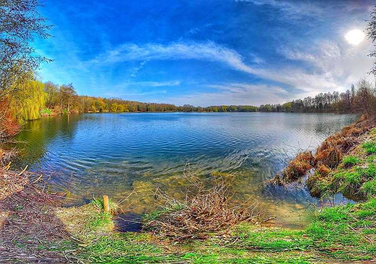
Photo: Dano1024, CC BY-SA 4.0.
Gießener Bergwerkswald is a nature reserve.
Mathematikum
Museum

Photo: Sicherlich, CC BY-SA 3.0.
The Mathematikum is a science museum, located in Gießen, Germany, which offers a huge variety of mathematical hands-on exhibits. It was founded by Albrecht Beutelspacher, a German mathematician. Mathematikum is situated 3 km north of Oberhof.
Gießen station
Railway station
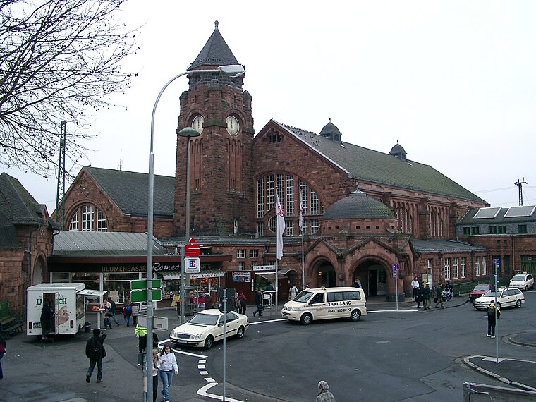
Photo: Randy43, Public domain.
Gießen railway station is the main railway station in Gießen, Hesse, Germany. The station is a Category 2 station is used by 20,000 passengers daily. The station was opened on 25 August 1850 and is located on the Main-Weser Railway and Dill railway. Gießen station is situated 3 km northwest of Oberhof.
Places in the Area
Nearby places include Linden and Annerod.
Linden
Village

Photo: Cherubino, CC BY-SA 3.0.
Linden is a town in the district of Gießen, in Hesse, Germany. It is situated 6 km south of Gießen. The town consists of the two parts Großen-Linden and Leihgestern. The Dießenbach, a small brook, flows into the Kleebach in Linden. Linden is situated 3½ km southwest of Oberhof.
Annerod
Village

Photo: Cherubino, CC BY-SA 4.0.
Annerod is a small village, part of the municipality Fernwald, in Germany between Gießen and Großen-Buseck approximately 70 km north of Frankfurt. Annerod has a population of about 3189 people. Annerod is situated 6 km northeast of Oberhof.

Oberhof
- Type: Village
- Category: locality
- Location: Gießen, Giessen, North Hesse, Hesse, Germany, Central Europe, Europe
- View on OpenStreetMap
Latitude
50.55613° or 50° 33′ 22″ northLongitude
8.67855° or 8° 40′ 43″ eastOpen location code
9F2CHM4H+FCOpenStreetMap ID
node 6515014409OpenStreetMap feature
place=village
This page is based on OpenStreetMap, Wikidata, and Wikimedia Commons.
We’d love your help improving our open data sources. Thank you for contributing.
Satellite Map
Discover Oberhof from above in high-definition satellite imagery.
Places with the Same Name
Discover other places named “Oberhof”.
Localities in the Area
Explore places such as Schinderskopfhege and Bergwerkswald.
Notable Places Nearby
Highlights include Legendary Lasertag Giessen and Day Night Sports.
North Hesse: Must-Visit Destinations
Delve into Kassel, Wetzlar, Marburg, and Fulda.
Curious Villages to Discover
Uncover intriguing villages from every corner of the globe.
About Mapcarta. Data © OpenStreetMap contributors and available under the Open Database License". Text is available under the CC BY-SA 4.0 license, except for photos, directions, and the map. Photo: Adam63, CC BY-SA 3.0.