Košice Self-governing Region
The Košice Self-governing Region or the Košice Higher Territorial Unit is one of Slovakia's eight "self-governing regions" whose territory is identical with that of the administrative Košice Region.| Tap on a place to explore it |
- Opening hours:
Monday—Tuesday: 7:30 AM—3:30 PM
Wednesday: 7:30 AM—4:30 PM
Thursday: 7:30 AM—3:30 PM
7:30—2:30 PM - Email: lubomir.dajcar@vucke.sk
- Type: Government office
- Description: self-governing region in Slovakia
- Also known as: “Kosicky samospravny kraj”, “KSK”, and “Úrad Košického samosprávneho kraja”
- Wheelchair access: yes
Places of Interest Nearby
Highlights include East Slovak Museum and Námestie Maratónu mieru.
East Slovak Museum
Museum
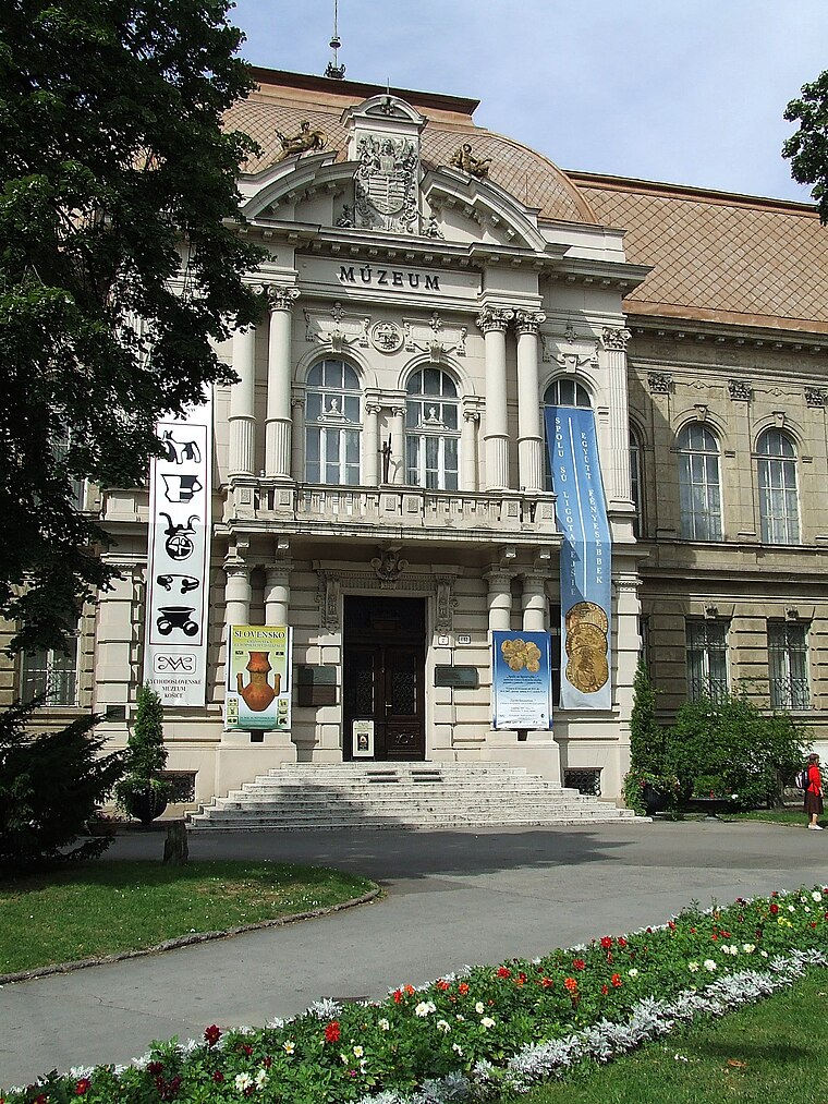
Photo: Wikimedia, CC BY-SA 3.0.
The East Slovak Museum in Košice, Slovakia, is one of the oldest Slovak museums, founded in 1872. It is located in the Old Town borough of Košice, at Námestie Maratónu mieru.

Temple of St Nicholas, Košice
Church

Photo: Jan Starec, CC BY-SA 3.0.
Temple of St Nicholas, Košice is a church, which is situated 110 metres southwest of Košice Self-governing Region.
Places in the Area
Nearby places include Košice and Košice-Sever.
Košice

Photo: Ville Miettinen, CC BY 2.0.
Košice is the second largest city in Slovakia, with a population of almost 240,000. It was the European Capital of Culture in 2013. Despite its relative remoteness, you may likely find Košice a hidden, unknown and approachable gem when seeking for a lesson in less known European history, lively arts scene or for a less spiritual entertainment thanks to its vibrant party scene.
Košice-Sever
Suburb
 Košice-Sever is a borough of Košice, Slovakia. Located in the Košice I district, it lies at an altitude of roughly 260 metres above sea level. It is one of the more populous boroughs of the city, as well as the largest of all 22 boroughs, which contributes to its low overall population density.
Džungľa
Suburb

Photo: Adehertogh, CC BY-SA 3.0.
Džungľa is a borough of Košice, Slovakia. The borough is situated in the Košice I district and lies to the northeast of the neighbouring borough of Košice Old Town, at an altitude of roughly 209 metres above sea level.
Košice Self-governing Region
- Categories: self-governing region of Slovakia, office, and government building
- Location: Old Town, Košice I, Košice Region, Slovakia, Central Europe, Europe
- View on OpenStreetMap
Latitude
48.72757° or 48° 43′ 39″ northLongitude
21.25441° or 21° 15′ 16″ eastOperator
Košický samosprávny krajOpen location code
8GW3P7H3+2QOpenStreetMap ID
node 659993406OpenStreetMap feature
office=governmentOpenStreetMap attribute
wheelchair=yesWikidata ID
Q4181793
This page is based on OpenStreetMap, Wikidata, Wikimedia Commons, and Wikipedia.
We’d love your help improving our open data sources. Thank you for contributing.
Satellite Map
Discover Košice Self-governing Region from above in high-definition satellite imagery.
In Other Languages
From Chinese to Slovak—“Košice Self-governing Region” goes by many names.
- Chinese: “科希策自治區”
- Czech: “Košický samosprávný kraj”
- French: “collectivité régionale de Košice”
- French: “Collectivité régionale de Košice”
- Japanese: “コシツェ自治地域”
- Slovak: “Košický samosprávny kraj”
- Slovak: “KSK”
Notable Places Nearby
Highlights include Východoslovenské múzeum and Košice Peace Marathon.
Nearby Places
Explore places such as Rudolf Viest and Vojtech Bukovský.
Slovakia: Must-Visit Destinations
Delve into Bratislava, Košice, Banská Bystrica, and Prešov.
Curious Government Offices to Discover
Uncover intriguing government offices from every corner of the globe.
About Mapcarta. Data © OpenStreetMap contributors and available under the Open Database License". Text is available under the CC BY-SA 4.0 license, except for photos, directions, and the map. Description text is based on the Wikipedia page “Košice Self-governing Region”. Photo: Danapit, CC BY-SA 3.0.