Le pont bascule
Le pont bascule is in Saint-Julien-du-Pinet, Arrondissement of Yssingeaux, Auvergne-Rhône-Alpes. Le pont bascule is situated nearby to the ruins Ruines de la Gare, as well as near the peak Suc de Charbonnière.| Tap on a place to explore it |
Places of Interest Nearby
Highlights include Chapelle Notre-Dame de Glavenas and Église Saint-Jean-Baptiste de Bessamorel.
Chapelle Notre-Dame de Glavenas
Church

Photo: PEJKERT Michel, CC BY-SA 3.0.
Chapelle Notre-Dame de Glavenas is a church, which is situated 1 km northwest of Le pont bascule.
Église Saint-Jean-Baptiste de Bessamorel
Church

Photo: Ludo29, CC BY-SA 3.0.
Église Saint-Jean-Baptiste de Bessamorel is a church, which is situated 2 km east of Le pont bascule.
Église Saint-Barthélemy du Pertuis
Church

Photo: Tournasol7, CC BY-SA 4.0.
Église Saint-Barthélemy du Pertuis is a church, which is situated 3½ km south of Le pont bascule.
Places in the Area
Nearby places include Bessamorel and Yssingeaux.
Bessamorel
Village

Photo: Ludo29, CC BY-SA 3.0.
Bessamorel is a commune in the Haute-Loire department in south-central France.
Yssingeaux
Town

Photo: Ludo29, CC BY-SA 3.0.
Yssingeaux is a commune and subprefecture in the Haute-Loire department in south-central France. It is situated between Le Puy-en-Velay and Firminy. Yssingeaux is situated 5 km east of Le pont bascule.
Mézères
Village
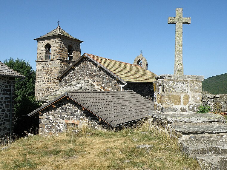
Photo: Wikimedia, Public domain.
Mézères is a commune in the Haute-Loire department in south-central France. Mézères is situated 5 km northwest of Le pont bascule.
Le pont bascule
- Type: Sign
- Categories: information and tourism
- Location: Saint-Julien-du-Pinet, Arrondissement of Yssingeaux, Haute-Loire, Auvergne-Rhône-Alpes, France, Europe
- View on OpenStreetMap
Latitude
45.12741° or 45° 7′ 39″ northLongitude
4.06703° or 4° 4′ 1″ eastOpen location code
8FQ643G8+XROpenStreetMap ID
node 6613014496OpenStreetMap feature
tourism=information
This page is based on OpenStreetMap, Wikidata, and Wikimedia Commons.
We’d love your help improving our open data sources. Thank you for contributing.
Satellite Map
Discover Le pont bascule from above in high-definition satellite imagery.
Notable Places Nearby
Highlights include Ruines de la Gare and Suc de Charbonnière.
Nearby Places
Explore places such as La Via Fluvia Saint-Julien-du-Pinet and Aire Via Fluvia de Saint-Julien-du-Pinet.
Auvergne-Rhône-Alpes: Must-Visit Destinations
Delve into Lyon, Grenoble, Clermont-Ferrand, and Saint-Étienne.
Curious Places to Discover
Uncover intriguing places from every corner of the globe.
About Mapcarta. Data © OpenStreetMap contributors and available under the Open Database License". Text is available under the CC BY-SA 4.0 license, except for photos, directions, and the map. Photo: Pedelecs, CC BY-SA 3.0.