Straßenbahn Denkmal
Straßenbahn Denkmal is a memorial in Hohenstein-Ernstthal, Zwickau, Saxony. Straßenbahn Denkmal is situated nearby to the railway station Hohenstein-Ernstthal station, as well as near the courthouse Amtsgericht Hohenstein Ernstthal.| Tap on a place to explore it |
Places of Interest Nearby
Highlights include Hohenstein-Ernstthal station and Capitol-Filmtheater.
Hohenstein-Ernstthal station
Railway station

Photo: Chris655, CC BY-SA 3.0.
Hohenstein-Ernstthal station is the railway station of Hohenstein-Ernstthal in the south west of the German State of Saxony. The station is classified as a category 5 station by DB Station&Service and has two platform tracks.
Capitol-Filmtheater
Movie theater

Photo: Aarp65, CC BY-SA 4.0.
Capitol-Filmtheater is a movie theater, which is situated 240 metres north of Straßenbahn Denkmal.
Rathaus Hohenstein-Ernstthal
Town hall
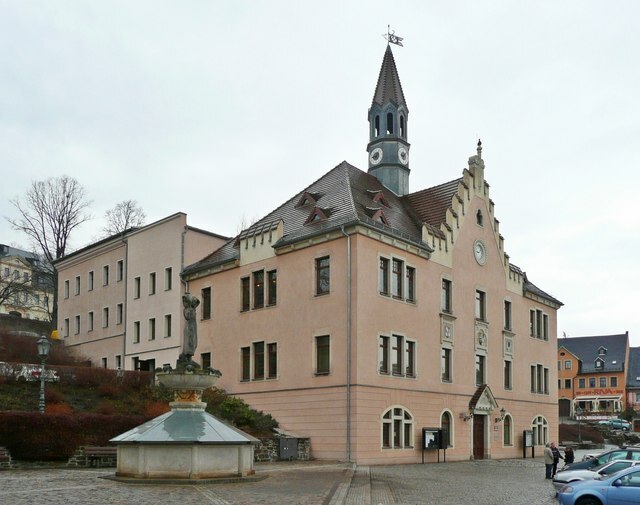
Photo: Wikimedia, CC BY-SA 2.0.
Rathaus Hohenstein-Ernstthal is a town hall, which is situated 370 metres north of Straßenbahn Denkmal.
Places in the Area
Nearby places include Hohenstein-Ernstthal and Hohenstein.
Hohenstein-Ernstthal
Town

Photo: Tkarcher (usurped), Public domain.
Hohenstein-Ernstthal is a town in the Zwickau rural district, Saxony, Germany. The towns of Hohenstein and Ernstthal were united in 1898, and the town is either known by its hyphenated form, or simply called Hohenstein.


Straßenbahn Denkmal
- Type: Memorial
- Inscription: “Straßenbahn Hohenstein-Ernstthal–Oelsnitz”
- Category: historic site
- Location: Hohenstein-Ernstthal, Zwickau, Saxony, Germany, Central Europe, Europe
- View on OpenStreetMap
Latitude
50.79907° or 50° 47′ 57″ northLongitude
12.7063° or 12° 42′ 23″ eastOpen location code
9F2JQPX4+JGOpenStreetMap ID
node 6643838320OpenStreetMap feature
historic=memorial
This page is based on OpenStreetMap, Wikidata, and Wikimedia Commons.
We’d love your help improving our open data sources. Thank you for contributing.
Satellite Map
Discover Straßenbahn Denkmal from above in high-definition satellite imagery.
Places with the Same Name
Discover other places named “Straßenbahn Denkmal”.
Notable Places Nearby
Highlights include Amtsgericht Hohenstein Ernstthal and Deutsche Post Office 540.
Nearby Places
Explore places such as Hohenstein-Ernstthal, Bahnhof and Bahnhof Hohenstein-Ernstthal.
Saxony: Must-Visit Destinations
Delve into Dresden, Leipzig, Chemnitz, and Meißen.
Curious Memorials to Discover
Uncover intriguing memorials from every corner of the globe.
About Mapcarta. Data © OpenStreetMap contributors and available under the Open Database License". Text is available under the CC BY-SA 4.0 license, except for photos, directions, and the map. Photo: Taxiarchos228, FAL.