Korona Leuchten
Korona Leuchten is a shop in Augsburg, Bavarian Swabia, Bavaria which is located on Kirchbergstraße. Korona Leuchten is situated nearby to the church Christus Zentrum Augsburg, as well as near the sports venue Sport Sheds.| Tap on a place to explore it |
Places of Interest Nearby
Highlights include Augsburg Railway Station and Stadtpfarrkirche Herz-Jesu.
Augsburg Railway Station
Railway station

Photo: Wikimedia, CC BY-SA 3.0.
Augsburg Hauptbahnhof is the main railway station in the Bavarian city of Augsburg, situated in southern Germany. It is classified by Deutsche Bahn as a category 2 station and has 12 platform tracks. Augsburg Railway Station is situated 1 km east of Korona Leuchten.
Stadtpfarrkirche Herz-Jesu
Church
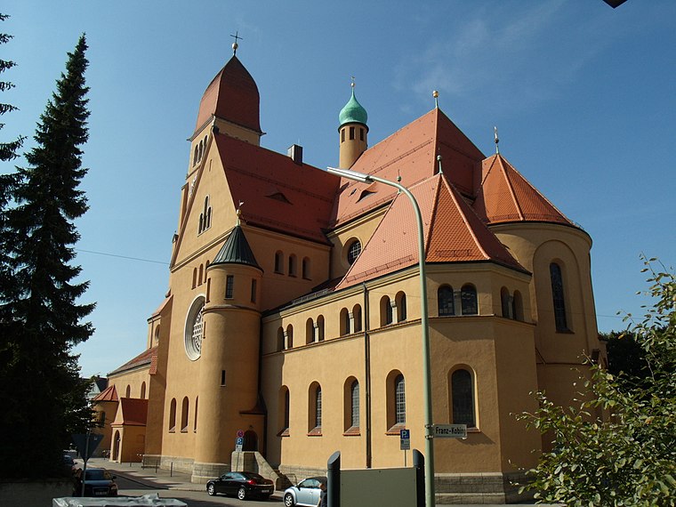
Photo: Richard Mayer, CC BY-SA 3.0.
Stadtpfarrkirche Herz-Jesu is a church, which is situated 460 metres south of Korona Leuchten.
Rosenaustadion
Stadium
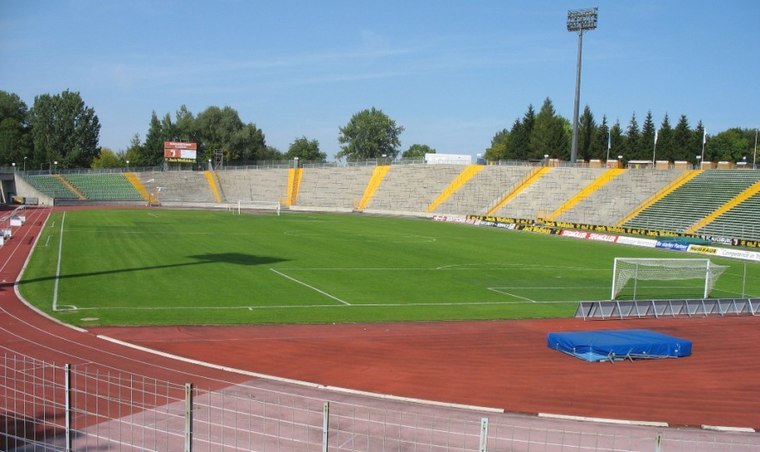
Photo: Wikimedia, CC BY-SA 3.0.
Rosenaustadion is a multi-purpose stadium in Augsburg, Bavaria, Germany. Built in 1951, it is a heritage listed monument and was the largest stadium in Augsburg for 58 years until 2009 when the Augsburg Arena was opened. Rosenaustadion is situated 1¼ km south of Korona Leuchten.
Places in the Area
Nearby places include Pfersee and Augsburg-Innenstadt.
Pfersee
Suburb
Pfersee is a part of the city of Augsburg, Bavaria with some 25.000 inhabitants on the western shore of river Wertach. In 1911 Pfersee was incorporated to Augsburg.
Augsburg-Innenstadt
Suburb

Photo: Wikimedia, CC BY-SA 3.0.
Augsburg Innenstadt is one of the seventeen highest level civic divisions, or Planungsräume, of the city of Augsburg, Bavaria, Germany. Located in the centre of the city, it is the most populated planning district, home to 49,222 residents as of December 31, 2022.
Augsburg-Bismarckviertel
Neighborhood

Photo: Wikimedia, CC BY-SA 3.0.
Augsburg-Bismarckviertel is a neighborhood.
Korona Leuchten
- Type: Shop
- Address: Kirchbergstraße 23, Augsburg, 86157
- Location: Augsburg, Bavarian Swabia, Bavaria, Germany, Central Europe, Europe
- View on OpenStreetMap
Latitude
48.36669° or 48° 22′ 0″ northLongitude
10.87316° or 10° 52′ 23″ eastOpen location code
8FWG9V8F+M7OpenStreetMap ID
node 6646555775OpenStreetMap feature
shop=lighting
This page is based on OpenStreetMap, Wikidata, and Wikimedia Commons.
We’d love your help improving our open data sources. Thank you for contributing.
Satellite Map
Discover Korona Leuchten from above in high-definition satellite imagery.
Notable Places Nearby
Highlights include Christus Zentrum Augsburg and Sport Sheds.
Nearby Places
Explore places such as Tagesstätte für psychisch Kranke - Betreutes Wohnen für psychisch kranke Augsburger Bürger/innen and Eberle.
Bavarian Swabia: Must-Visit Destinations
Delve into Memmingen, Kempten, Füssen, and Lindau.
Curious Shops to Discover
Uncover intriguing shops from every corner of the globe.
About Mapcarta. Data © OpenStreetMap contributors and available under the Open Database License". Text is available under the CC BY-SA 4.0 license, except for photos, directions, and the map. Photo: Tilman2007, CC BY-SA 3.0.