東京都大島支庁神津島出張所
東京都大島支庁神津島出張所 is a government office in Kōzushima Mura, Ōshima Subprefecture, Tokyo. 東京都大島支庁神津島出張所 is situated nearby to Kozu High School, as well as near Kozushima Post Office.| Tap on a place to explore it |
Places of Interest Nearby
Highlights include Kozushima and Monoimina no Mikoto Shrine.
Kozushima

Photo: Saigen Jiro, CC0.
Kōzushima is a volcanic island in Tokyo prefecture, about 170 km south of Tokyo city in the Philippine Sea. It is one of the Izu Seven Islands group of the seven northern islands of the Izu archipelago.
Monoimina no Mikoto Shrine
Shinto shrine
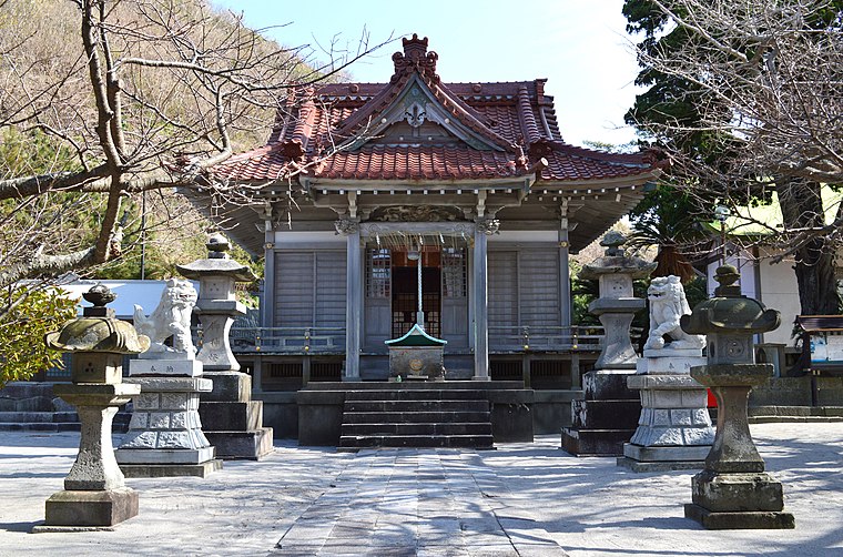
Photo: Saigen Jiro, CC0.
Monoimina no Mikoto Shrine is a Shinto shrine, which is situated 600 metres north of 東京都大島支庁神津島出張所.
Kōzushima Airport
Aerodrome
Photo: Saigen Jiro, CC0.
Kōzushima Airport is a regional airport serving Kōzushima in the northern Izu Islands, Tokyo, Japan. Operated by the Tokyo government, it is located 1.7 NM south of the Kōzushima village office. It began operations in July 1992.
Places in the Area
Nearby places include Kozushima.
Kozushima
Village
 Kōzushima Village is a village located in Ōshima Subprefecture, Tokyo Metropolis, Japan. As of 1 June 2022, the village had an estimated population of 1,841, and a population density of 99 persons per km2. Its total area is 18.58 square kilometres.
東京都大島支庁神津島出張所
- Type: Government office
- Categories: office and government building
- Location: Kōzushima Mura, Ōshima Subprefecture, Tokyo, Japan, East Asia, Asia
- View on OpenStreetMap
Latitude
34.20309° or 34° 12′ 11″ northLongitude
139.13374° or 139° 8′ 2″ eastOpen location code
8Q6X643M+6FOpenStreetMap ID
node 6665204957OpenStreetMap feature
office=government
This page is based on OpenStreetMap, Wikidata, and Wikimedia Commons.
We’d love your help improving our open data sources. Thank you for contributing.
Satellite Map
Discover 東京都大島支庁神津島出張所 from above in high-definition satellite imagery.
Notable Places Nearby
Highlights include Kozu High School and Kozushima Post Office.
Nearby Places
Explore places such as 年間民宿 元造 and 双葉屋.
Japan: Must-Visit Destinations
Delve into Tokyo, Osaka, Kyoto, and Yokohama.
Curious Government Offices to Discover
Uncover intriguing government offices from every corner of the globe.
About Mapcarta. Data © OpenStreetMap contributors and available under the Open Database License". Text is available under the CC BY-SA 4.0 license, except for photos, directions, and the map. Photo: JurriaanH, CC BY-SA 3.0.