Rötlicher Granitgneis-Findling
Rötlicher Granitgneis-Findling is in Lower Saxony, Germany. Rötlicher Granitgneis-Findling is situated nearby to the village Husum.| Tap on a place to explore it |
Places in the Area
Nearby places include Husum and Landesbergen.
Husum
Village
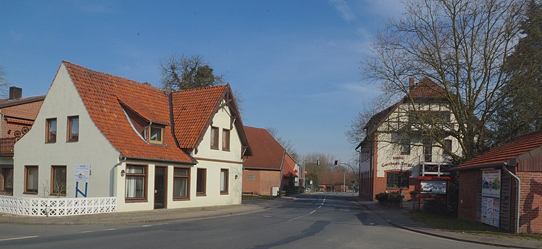
Photo: flamenc, CC BY-SA 3.0.
Husum is a municipality in the district of Nienburg, in Lower Saxony, Germany. Husum is situated 5 km northeast of Rötlicher Granitgneis-Findling.
Landesbergen
Village
Landesbergen is a municipality in the district of Nienburg, in Lower Saxony, Germany. It is situated on the right bank of the Weser, approx. 10 km southwest of Nienburg, and 35 km northeast of Minden. Landesbergen is situated 7 km northwest of Rötlicher Granitgneis-Findling.
Leese
Village

Photo: Losch, CC BY-SA 3.0.
Leese is a municipality in the district of Nienburg, in Lower Saxony, Germany. Leese is situated 7 km west of Rötlicher Granitgneis-Findling.
Rötlicher Granitgneis-Findling
- Type: Rock
- Categories: tourism, tourist attraction, and landform
- Location: Lower Saxony, Germany, Central Europe, Europe
- View on OpenStreetMap
Latitude
52.5289° or 52° 31′ 44″ northLongitude
9.21518° or 9° 12′ 55″ eastOpen location code
9F4FG6H8+H3OpenStreetMap ID
node 6677791743OpenStreetMap feature
natural=rockOpenStreetMap feature
tourism=attraction
This page is based on OpenStreetMap, Wikidata, and Wikimedia Commons.
We’d love your help improving our open data sources. Thank you for contributing.
Satellite Map
Discover Rötlicher Granitgneis-Findling from above in high-definition satellite imagery.
Notable Places Nearby
Highlights include Brokeloher Heide and Brokeloher Moorhof.
Nearby Places
Explore places such as Hermann-Löns-Wanderweg, Punkt 6 and Brokeloher Mühle.
Lower Saxony: Must-Visit Destinations
Delve into Hanover, Göttingen, Brunswick, and Wolfsburg.
Curious Places to Discover
Uncover intriguing places from every corner of the globe.
About Mapcarta. Data © OpenStreetMap contributors and available under the Open Database License". Text is available under the CC BY-SA 4.0 license, except for photos, directions, and the map. Photo: Danapit, CC BY-SA 3.0.