Sauersbergweg
Sauersbergweg is in Baden-Baden, Karlsruhe Region, Baden-Württemberg. Sauersbergweg is situated nearby to the library Information, Dokumentation und Archive Center, as well as near the building Hans-Rosbaud-Studio.| Tap on a place to explore it |
Places of Interest Nearby
Highlights include Hans-Rosbaud-Studio and Museum Frieder Burda.
Hans-Rosbaud-Studio
Building

Photo: Sitacuisses, CC BY-SA 3.0.
Hans-Rosbaud-Studio is a building, which is situated 340 metres northwest of Sauersbergweg.
Museum Frieder Burda
Museum
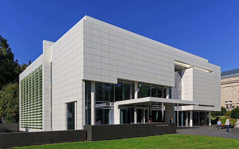
Photo: A.Savin, CC BY-SA 3.0.
Museum Frieder Burda is situated 1½ km northeast of Sauersbergweg.
Stolperstein dedicated to Julius Mayer
Memorial
 Stolperstein dedicated to Julius Mayer is a memorial, which is situated 580 metres north of Sauersbergweg.
Places in the Area
Nearby places include Varnhalt and Neuweier.
Varnhalt
Village

Photo: Gerd Eichmann, CC BY-SA 4.0.
Varnhalt is a village to the north of the town of Steinbach in Baden-Württemberg southwestern Germany. Since 1972, Varnhalt has become a suburb of the spa town of Baden-Baden, together with Steinbach and Neuweier. Varnhalt is situated 3½ km west of Sauersbergweg.
Neuweier
Village

Photo: SBL1980, CC BY-SA 3.0 de.
Neuweier is a village to the east of the town of Steinbach in Southwest Germany. It is located in a valley on both sides of the Steinbach stream extending into the foothills of the Black Forest mountain range. Neuweier is situated 4 km southwest of Sauersbergweg.
Steinbach
Village

Photo: Gerd Eichmann, CC BY-SA 4.0.
Steinbach is a town to the North of Bühl in Baden-Württemberg, which is a state in Southwest Germany. In 1972 Steinbach became a suburb of the spa town of Baden-Baden, together with Neuweier and Varnhalt. In 2004, the population of Steinbach was about 5000. Steinbach is situated 5 km west of Sauersbergweg.
Sauersbergweg
- Type: Sign
- Categories: information and tourism
- Location: Baden-Baden, Karlsruhe Region, Black Forest, Baden-Württemberg, Germany, Central Europe, Europe
- View on OpenStreetMap
Latitude
48.74595° or 48° 44′ 45″ northLongitude
8.22508° or 8° 13′ 30″ eastElevation
310 metres (1,017 feet)Operator
SchwarzwaldvereinOpen location code
8FWCP6WG+92OpenStreetMap ID
node 6682251317OpenStreetMap feature
tourism=information
This page is based on OpenStreetMap, Wikidata, and Wikimedia Commons.
We’d love your help improving our open data sources. Thank you for contributing.
Satellite Map
Discover Sauersbergweg from above in high-definition satellite imagery.
Notable Places Nearby
Highlights include Information, Dokumentation und Archive Center and NEXUS-Klinik Baden-Baden.
Nearby Places
Explore places such as Waldhaus Batschari and Pfaffenbrunnen.
Black Forest: Must-Visit Destinations
Delve into Freiburg, Pforzheim, Villingen-Schwenningen, and Offenburg.
Curious Places to Discover
Uncover intriguing places from every corner of the globe.
About Mapcarta. Data © OpenStreetMap contributors and available under the Open Database License". Text is available under the CC BY-SA 4.0 license, except for photos, directions, and the map. Photo: Llez, CC BY-SA 3.0.