Rade de Brest / Elom maritime
Rade de Brest / Elom maritime is in Brittany, France. Rade de Brest / Elom maritime is situated nearby to the hamlet Porzh Meur, as well as near Ti Floc’h.| Tap on a place to explore it |
Places of Interest
Highlights include Île Ronde and Portzic Lighthouse.
Île Ronde
Islet

Photo: Larvor, CC BY-SA 3.0.
The Île Ronde is a French islet 400 metres to the south west of Pointe de l’Armorique, in the roadstead of Brest, within the territory of the commune of Plougastel-Daoulas.
Portzic Lighthouse
Lighthouse

Photo: Pline, CC BY-SA 3.0.
The Portzic Lighthouse is situated on the north-eastern extremity of the Goulet de Brest and is the nearest lighthouse to the town of Brest. It is a 35 metres tall octagonal tower.
Submarine base of Brest
Bunker
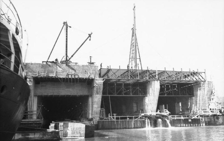
Photo: Wikimedia, CC BY-SA 3.0 de.
Submarine base of Brest is a bunker.
Places in the Area
Nearby places include Brest and Recouvrance.
Brest

Photo: Inkey, CC BY-SA 2.5.
Brest is a city on the west Atlantic coast of France. It has a long history of navigation. There are very large tides here.
Recouvrance
Suburb

Photo: S. DÉNIEL, CC BY-SA 4.0.
Recouvrance is the section of the city of Brest, France, on the right bank of the River Penfeld. The popular and historically-Breton quarter is in contrast to the largely-Francophone quarter of Brest-même or Brest-proper, on the left bank.

Rade de Brest / Elom maritime
- Type: Wetland
- Category: body of water
- Location: Brittany, France, Europe
- View on OpenStreetMap
Latitude
48.3389° or 48° 20′ 20″ northLongitude
-4.4915° or 4° 29′ 30″ westOpen location code
8CWQ8GQ5+H9OpenStreetMap ID
node 6723403313OpenStreetMap feature
natural=wetland
This page is based on OpenStreetMap, Wikidata, and Wikimedia Commons.
We’d love your help improving our open data sources. Thank you for contributing.
Satellite Map
Discover Rade de Brest / Elom maritime from above in high-definition satellite imagery.
Localities in the Area
Explore places such as Porzh Meur and Ti Floc’h.
Notable Places Nearby
Highlights include Île Ronde and Fort de l’Armorique.
Brittany: Must-Visit Destinations
Delve into Rennes, Brest, Finistère, and Morbihan.
Curious Places to Discover
Uncover intriguing places from every corner of the globe.
About Mapcarta. Data © OpenStreetMap contributors and available under the Open Database License". Text is available under the CC BY-SA 4.0 license, except for photos, directions, and the map. Photo: Spendeau, CC BY-SA 3.0.