Taberna Oliveira
Taberna Oliveira is a pub in Ribeira de Nisa e Carreiras, Portalegre. Taberna Oliveira is situated nearby to the village Fortios.| Tap on a place to explore it |
Places of Interest Nearby
Highlights include Igreja do Bonfim and Plane tree from Rossio.
Igreja do Bonfim
Church

Photo: Vitor Oliveira, CC BY-SA 2.0.
Igreja do Bonfim is a church, which is situated 3 km south of Taberna Oliveira.
Plane tree from Rossio

Photo: Wikimedia, CC BY-SA 4.0.
Plane tree from Rossio is situated 4 km south of Taberna Oliveira.
Capela do Calvário
Church
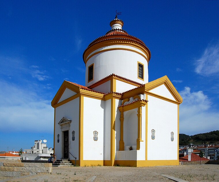
Photo: Sacavem, CC BY-SA 3.0.
Capela do Calvário is a church, which is situated 4 km south of Taberna Oliveira.
Places in the Area
Nearby places include Fortios and Alagoa.
Fortios
Village

Photo: Joseolgon, CC BY-SA 3.0.
Fortios is a village, which is situated 4½ km west of Taberna Oliveira.
Alagoa
Village

Photo: Nuno Morão, CC BY-SA 2.0.
Alagoa is a village, which is situated 9 km west of Taberna Oliveira.
Marvão

Photo: Stephen Colebourne, CC BY 2.0.
Marvão is a mountain village of 3,000 people in Alentejo perched on a quartzite crag of the Serra de São Mamede.
Taberna Oliveira
- Type: Pub
- Location: Ribeira de Nisa e Carreiras, Portalegre, Portalegre District, Portugal, Iberia, Europe
- View on OpenStreetMap
Latitude
39.32951° or 39° 19′ 46″ northLongitude
-7.44505° or 7° 26′ 42″ westOpen location code
8CFJ8HH3+RXOpenStreetMap ID
node 6725590986OpenStreetMap feature
amenity=pub
This page is based on OpenStreetMap, Wikidata, and Wikimedia Commons.
We’d love your help improving our open data sources. Thank you for contributing.
Satellite Map
Discover Taberna Oliveira from above in high-definition satellite imagery.
Notable Places Nearby
Highlights include Miradouro and Fonte.
Nearby Places
Explore places such as Jardim de Infância de Vargem and Quinta de São Vicente Zona Industrial e Logistica.
Portugal: Must-Visit Destinations
Delve into Lisbon, Caldas da Rainha, Porto, and Coimbra.
Curious Pubs to Discover
Uncover intriguing pubs from every corner of the globe.
About Mapcarta. Data © OpenStreetMap contributors and available under the Open Database License". Text is available under the CC BY-SA 4.0 license, except for photos, directions, and the map. Photo: Tsy1980, CC BY-SA 4.0.