Senda Las Barderas
Senda Las Barderas is in El Frasno Municipality, Saragossa, Aragon. Senda Las Barderas is situated nearby to the peak Cerro Ceragomez, as well as near the mountain saddle Collado Mayor.| Tap on a place to explore it |
Places in the Area
Nearby places include Santa Cruz de Grío Municipality and El Frasno.
Santa Cruz de Grío Municipality
Village

Photo: Jaime Calatayud, CC BY-SA 4.0.
Santa Cruz de Grío is a municipality located in the province of Zaragoza, Aragon, Spain. According to the 2010 census, the municipality has a population of 164 inhabitants. Santa Cruz de Grío Municipality is situated 3 km east of Senda Las Barderas.
El Frasno
Village
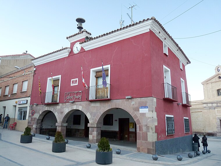
Photo: Ecelan, CC BY-SA 3.0.
El Frasno is a municipality in the province of Zaragoza, Aragon, Spain. According to the 2004 census, the municipality had a population of 476 inhabitants. El Frasno is situated 5 km northwest of Senda Las Barderas.
Sediles
Village

Photo: Jaime Calatayud, CC BY-SA 4.0.
Sediles is a municipality located in the Comunidad de Calatayud, province of Zaragoza, Aragon, Spain. According to the 2004 census, the municipality has a population of 93 inhabitants. The town is located at the feet of the Sierra de Vicort range. Sediles is situated 7 km southwest of Senda Las Barderas.
Senda Las Barderas
- Type: Sign
- Categories: information and tourism
- Location: El Frasno Municipality, Saragossa, Aragon, Northern Spain, Spain, Iberia, Europe
- View on OpenStreetMap
Latitude
41.37685° or 41° 22′ 37″ northLongitude
-1.46315° or 1° 27′ 47″ westOpen location code
8CHW9GGP+PPOpenStreetMap ID
node 6729559425OpenStreetMap feature
tourism=information
This page is based on OpenStreetMap, Wikidata, and Wikimedia Commons.
We’d love your help improving our open data sources. Thank you for contributing.
Satellite Map
Discover Senda Las Barderas from above in high-definition satellite imagery.
Notable Places Nearby
Highlights include Cerro Ceragomez and Collado Mayor.
Nearby Places
Explore places such as Ermita de la Virgen de Jerusalen and Paridera Fernanda.
Aragon: Must-Visit Destinations
Delve into Zaragoza, Huesca, Teruel, and Calatayud.
Curious Places to Discover
Uncover intriguing places from every corner of the globe.
About Mapcarta. Data © OpenStreetMap contributors and available under the Open Database License". Text is available under the CC BY-SA 4.0 license, except for photos, directions, and the map. Photo: Jiuguang Wang, CC BY-SA 3.0 es.