Vegebüdel
Vegebüdel is a social service facility in Bremen, Germany which is located on Sandersberg. Vegebüdel is situated nearby to the fire station Freiwillige Feuerwehr Bremen-Schönebeck, as well as near the post office Deutsche Post.| Tap on a place to explore it |
Places of Interest Nearby
Highlights include Holzkirche Schönebeck, Bremen and Bremen-Schönebeck station.
Holzkirche Schönebeck, Bremen
Church

Photo: Wilfried Willker, CC BY-SA 4.0.
Holzkirche Schönebeck, Bremen is a church, which is situated 640 metres northeast of Vegebüdel.
Bremen-Schönebeck station
Railway stop

Photo: Clic, CC BY-SA 4.0.
Bremen-Schönebeck is a railway station serving the Schönebeck district of Bremen. The station is located on the Bremen-Vegesack–Bremen railway line. Bremen-Schönebeck station is situated 490 metres east of Vegebüdel.
Bremen-Vegesack station
Railway station
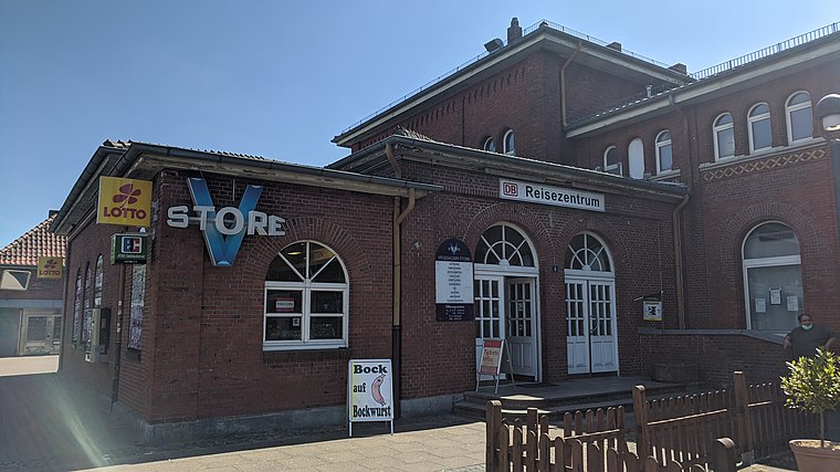
Photo: Clic, CC BY-SA 4.0.
Bremen-Vegesack is a railway station serving the Vegesack district of Bremen. The station is part of the Bremen-Farge railway line served by Bremen S-Bahn line RS1, operated by NordWestBahn. Bremen-Vegesack station is situated 1 km southwest of Vegebüdel.
Places in the Area
Nearby places include Grohner Düne and Bremen-Vegesack.

Bremen-Vegesack
Suburb

Photo: Dtuk, CC BY-SA 3.0.
Vegesack is a northern district of Bremen, the capital of the German state Free Hanseatic City of Bremen.

Vegebüdel
- Type: Social service facility
- Address: Sandersberg 13a, Bremen, 28757
- Location: Bremen, City state Bremen, Germany, Central Europe, Europe
- View on OpenStreetMap
Latitude
53.17385° or 53° 10′ 26″ northLongitude
8.64216° or 8° 38′ 32″ eastOperator
Sozialwerk der Freien christengemeinde Bremen e.V.Open location code
9F5C5JFR+GVOpenStreetMap ID
node 6738804338OpenStreetMap feature
amenity=social_facility
This page is based on OpenStreetMap, Wikidata, and Wikimedia Commons.
We’d love your help improving our open data sources. Thank you for contributing.
Satellite Map
Discover Vegebüdel from above in high-definition satellite imagery.
Notable Places Nearby
Highlights include Freiwillige Feuerwehr Bremen-Schönebeck and Deutsche Post.
Nearby Places
Explore places such as Sandersburg and Wohntraining.
Germany: Must-Visit Destinations
Delve into Berlin, Munich, Hamburg, and Frankfurt.
Curious Social Service Facilities to Discover
Uncover intriguing social service facilities from every corner of the globe.
About Mapcarta. Data © OpenStreetMap contributors and available under the Open Database License". Text is available under the CC BY-SA 4.0 license, except for photos, directions, and the map. Photo: Dschwen, CC BY-SA 3.0.