Freiwillige Feuerwehr Steppach
Freiwillige Feuerwehr Steppach is a fire station in Neusäß, Augsburg, Bavaria which is located on Kreppenweg. Freiwillige Feuerwehr Steppach is situated nearby to the playground Spielplatz Flurstraße, as well as near the church Pfarrkirche St. Raphael.| Tap on a place to explore it |
Places of Interest Nearby
Highlights include St. Gallus and Bismarck Tower (Augsburg).
St. Gallus
Church

Photo: Jkü, CC BY-SA 3.0.
St. Gallus is a church, which is situated 260 metres southeast of Freiwillige Feuerwehr Steppach.
Bismarck Tower (Augsburg)
Tower

Photo: Muck50, CC BY-SA 4.0.
Bismarck Tower (Augsburg) is situated 560 metres southeast of Freiwillige Feuerwehr Steppach.
Bezirkskrankenhaus Augsburg
Hospital
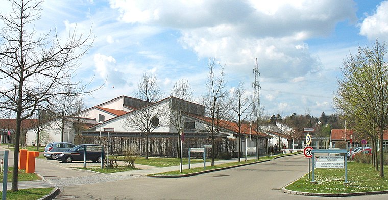
Photo: Wikimedia, CC BY-SA 3.0.
Bezirkskrankenhaus Augsburg is a hospital, which is situated 1¼ km northeast of Freiwillige Feuerwehr Steppach.
Places in the Area
Nearby places include Steppach and Westheim.


Stadtbergen
Town
 Stadtbergen is a town in the district of Augsburg, in Bavaria, Germany. It is situated in the outskirts of Augsburg, 4 kilometres west of Augsburg city centre. Stadtbergen was granted town privileges in May 2007.
Freiwillige Feuerwehr Steppach
- Type: Fire station
- Address: Kreppenweg 28, Steppach, Neusäß, 86356
- Location: Neusäß, Augsburg, Bavarian Swabia, Bavaria, Germany, Central Europe, Europe
- View on OpenStreetMap
Latitude
48.37583° or 48° 22′ 33″ northLongitude
10.82461° or 10° 49′ 29″ eastOpen location code
8FWG9RGF+8ROpenStreetMap ID
node 674926119OpenStreetMap feature
amenity=fire_station
This page is based on OpenStreetMap, Wikidata, and Wikimedia Commons.
We’d love your help improving our open data sources. Thank you for contributing.
Satellite Map
Discover Freiwillige Feuerwehr Steppach from above in high-definition satellite imagery.
Places with the Same Name
Discover other places named “Freiwillige Feuerwehr Steppach”.
Notable Places Nearby
Highlights include Spielplatz Flurstraße and Pfarrkirche St. Raphael.
Nearby Places
Explore places such as EDEKA and Backstube Wünsche.
Bavarian Swabia: Must-Visit Destinations
Delve into Augsburg, Memmingen, Kempten, and Füssen.
Curious Fire Stations to Discover
Uncover intriguing fire stations from every corner of the globe.
About Mapcarta. Data © OpenStreetMap contributors and available under the Open Database License". Text is available under the CC BY-SA 4.0 license, except for photos, directions, and the map. Photo: Tilman2007, CC BY-SA 3.0.