OnServe
OnServe is an office in United Counties of Leeds and Grenville, Ontario which is located on Kent Boulevard. OnServe is situated nearby to Good Shepherd Lutheran Church, as well as near Thousand Islands Secondary School.| Tap on a place to explore it |
Places of Interest Nearby
Highlights include Thousand Islands Secondary School and Brockville Railway Station.
Thousand Islands Secondary School
School
Thousand Islands Secondary School is a public high school in the city of Brockville, Ontario and one of the most populous high school managed by the Upper Canada District School Board. Thousand Islands Secondary School is situated 470 metres north of OnServe.
Brockville Railway Station
Railway station
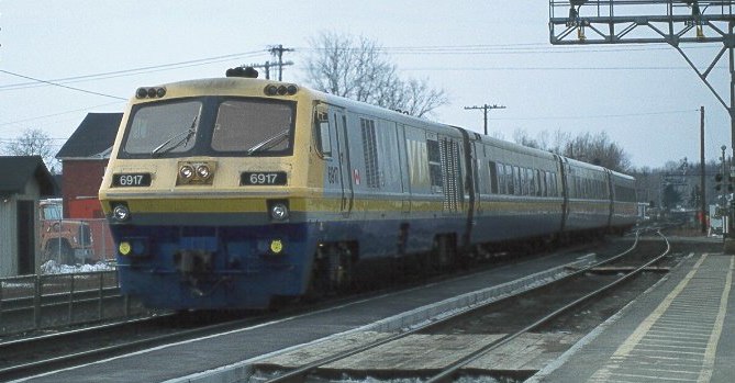
Photo: Wikimedia, CC BY-SA 3.0.
The Brockville railway station in Brockville, Ontario, Canada is served by Via Rail trains running from Toronto to Ottawa and Montreal. It is a staffed railway station, with ticket sales, outdoor parking, telephones, washrooms, and wheelchair access to the platform and trains. Brockville Railway Station is situated 1¼ km southeast of OnServe.
Leeds and Grenville County Court House
Courthouse

Photo: Taxiarchos228, CC BY-SA 3.0 de.
Leeds and Grenville County Court House is situated 2 km southeast of OnServe.
Places in the Area
Nearby places include Brockville and Maitland.
Brockville

Photo: P199, CC BY-SA 3.0.
Brockville is a city in Eastern Ontario, Canada, in the Thousand Islands region. Although it falls within the United Counties of Leeds and Grenville, it is politically independent of the county.
Maitland
Village

Photo: P199, CC BY-SA 3.0.
Maitland, Ontario is a small village within Augusta Township in the United Counties of Leeds and Grenville, Canada. It is located along the St. Lawrence River approximately five kilometres east of the city of Brockville. Maitland is situated 9 km northeast of OnServe.
OnServe
- Type: Business
- Address: 7712 Kent Boulevard
- Category: office
- Location: United Counties of Leeds and Grenville, Ontario, Canada, North America
- View on OpenStreetMap
Latitude
44.59897° or 44° 35′ 56″ northLongitude
-75.70661° or 75° 42′ 24″ westOpen location code
87P6H7XV+H9OpenStreetMap ID
node 6759487818OpenStreetMap feature
office=company
This page is based on OpenStreetMap, Wikidata, and Wikimedia Commons.
We’d love your help improving our open data sources. Thank you for contributing.
Satellite Map
Discover OnServe from above in high-definition satellite imagery.
Notable Places Nearby
Highlights include Good Shepherd Lutheran Church and Stingers Indoor Paintball.
Nearby Places
Explore places such as Majestik Communications and Total Image.
Ontario: Must-Visit Destinations
Delve into Toronto, Ottawa, Hamilton, and London.
Curious Places to Discover
Uncover intriguing places from every corner of the globe.
About Mapcarta. Data © OpenStreetMap contributors and available under the Open Database License". Text is available under the CC BY-SA 4.0 license, except for photos, directions, and the map. Photo: Wikimedia, CC BY-SA 2.0.