PumaKatari - Clavijo (San Pedro)
PumaKatari - Clavijo (San Pedro) is a bus stop in La Paz, Altiplano. PumaKatari - Clavijo (San Pedro) is situated nearby to Hospital CEMES, as well as near Hospital Virgen de La Asunción.| Tap on a place to explore it |
Places of Interest Nearby
Highlights include Apostolic nunciature and Embassy of the United States.
Apostolic nunciature
Government office
The Apostolic Nunciature to Bolivia the diplomatic mission of the Holy See to Bolivia. It is located in La Paz. The current Apostolic Nuncio to Bolivia is Angelo Accattino, who was appointed by Pope Francis on 12 September 2017. Apostolic nunciature is situated 140 metres southeast of PumaKatari - Clavijo (San Pedro).
Embassy of the United States
Government office
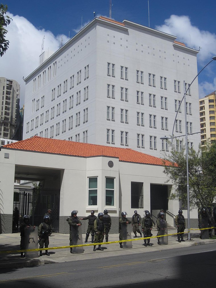
Photo: juhauski72, CC BY 2.0.
Embassy of the United States is a government office, which is situated 170 metres northwest of PumaKatari - Clavijo (San Pedro).
British Embassy
Government office

Photo: EEJCC, CC BY-SA 4.0.
British Embassy is a government office, which is situated 220 metres northwest of PumaKatari - Clavijo (San Pedro).
Places in the Area
Nearby places include La Paz and Calacoto.
La Paz
 La Paz is the administrative capital of Bolivia, while Sucre is the constitutional capital and the seat of the Supreme Court.
Calacoto
Suburb
Calacoto or Qalaqutu is a neighborhood in La Paz Municipality, Bolivia. It is located in the southern part of the city and is considered one of the largest residential zones due to the cost of the houses and the services available. Calacoto is situated 5 km southeast of PumaKatari - Clavijo (San Pedro).
Achocalla Municipality
Town

Photo: Meister, CC BY-SA 3.0.
Achocalla Municipality is the third municipal section of the Pedro Domingo Murillo Province in the La Paz Department, Bolivia. Its seat is Achocalla or Achuqalla in the native language. Achocalla Municipality is situated 8 km southwest of PumaKatari - Clavijo (San Pedro).
PumaKatari - Clavijo (San Pedro)
- Type: Bus stop
- Category: transportation
- Location: La Paz, Altiplano, Bolivia, South America
- View on OpenStreetMap
Latitude
-16.51373° or 16° 30′ 49″ southLongitude
-68.1204° or 68° 7′ 14″ westOperator
SETRAM - GAMLPNetwork
La Paz BusOpen location code
57MHFVPH+GROpenStreetMap ID
node 6760957774OpenStreetMap feature
highway=bus_stopOpenStreetMap feature
public_transport=platform
This page is based on OpenStreetMap, Wikidata, and Wikimedia Commons.
We’d love your help improving our open data sources. Thank you for contributing.
Satellite Map
Discover PumaKatari - Clavijo (San Pedro) from above in high-definition satellite imagery.
Notable Places Nearby
Highlights include Hospital CEMES and Hospital Virgen de La Asunción.
Nearby Places
Explore places such as La Vitalicia and National Instruments.
La Paz: Must-Visit Destinations
Delve into La Paz, Tiwanaku, Yungas Road, and Sorata.
Curious Bus Stops to Discover
Uncover intriguing bus stops from every corner of the globe.
About Mapcarta. Data © OpenStreetMap contributors and available under the Open Database License". Text is available under the CC BY-SA 4.0 license, except for photos, directions, and the map. Photo: Wikimedia, CC0.