Batsères
Batsères is a hamlet in Landiras, Arrondissement of Langon, Nouvelle-Aquitaine. Batsères is situated nearby to the locality Tanon, as well as near Gourgouille.| Tap on a place to explore it |
Places of Interest
Highlights include Église Saint-Martin de Landiras.
Église Saint-Martin de Landiras
Church

Photo: Henrysalome, CC BY-SA 3.0.
Église Saint-Martin de Landiras is a church, which is situated 3½ km northeast of Batsères.
Places in the Area
Nearby places include Guillos and Budos.
Guillos
Village

Photo: Henrysalome, CC BY-SA 3.0.
Guillos is a commune in the Gironde department in southwestern France. Guillos is situated 4½ km west of Batsères.
Budos
Village
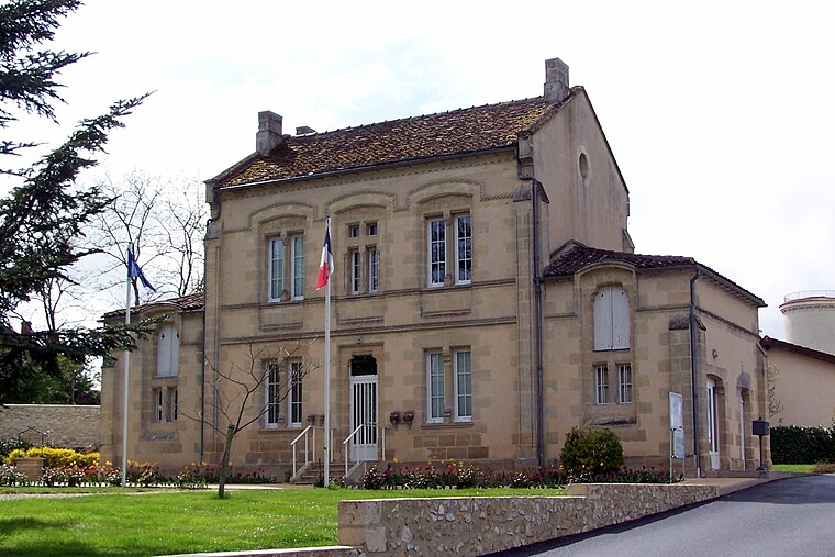
Photo: Henrysalome, CC BY-SA 3.0.
Budos is a commune in the Gironde department in Nouvelle-Aquitaine in southwestern France. Budos is situated 5 km east of Batsères.
Léogeats
Village

Photo: Henrysalome, CC BY-SA 4.0.
Léogeats is a commune in the Gironde department in Nouvelle-Aquitaine in southwestern France. Léogeats is situated 8 km southeast of Batsères.
Batsères
- Type: Hamlet
- Category: locality
- Location: Landiras, Arrondissement of Langon, Gironde, Nouvelle-Aquitaine, France, Europe
- View on OpenStreetMap
Latitude
44.54728° or 44° 32′ 50″ northLongitude
-0.44728° or 0° 26′ 50″ westOpen location code
8CPXGHW3+W3OpenStreetMap ID
node 681999023OpenStreetMap feature
place=hamlet
This page is based on OpenStreetMap, Wikidata, and Wikimedia Commons.
We’d love your help improving our open data sources. Thank you for contributing.
Satellite Map
Discover Batsères from above in high-definition satellite imagery.
Localities in the Area
Explore places such as Tanon and Gourgouille.
Notable Places Nearby
Highlights include Stade Louis Ricaud and Salle polyvalente.
Gironde: Must-Visit Destinations
Delve into Bordeaux, Arcachon, Saint-Émilion, and Soulac-sur-Mer.
Curious Hamlets to Discover
Uncover intriguing hamlets from every corner of the globe.
About Mapcarta. Data © OpenStreetMap contributors and available under the Open Database License". Text is available under the CC BY-SA 4.0 license, except for photos, directions, and the map. Photo: JLPC, CC BY-SA 3.0.