Les Arrougeys
Les Arrougeys is a hamlet in Landiras, Arrondissement of Langon, Nouvelle-Aquitaine. Les Arrougeys is situated nearby to the hamlet La Couleyre, as well as near Le Carpoula.| Tap on a place to explore it |
Places of Interest
Highlights include Église Saint-Martin de Landiras and Château de La Salle.
Église Saint-Martin de Landiras
Church

Photo: Henrysalome, CC BY-SA 3.0.
Église Saint-Martin de Landiras is a church.
Château de La Salle
Castle

Photo: Henrysalome, CC BY-SA 3.0.
Château de La Salle is a castle, which is situated 2½ km east of Les Arrougeys.
Château de Rayne-Vigneau
Castle

Photo: Henrysalome, CC BY-SA 3.0.
Château de Rayne-Vigneau is a sweet white wine ranked as Premier Cru Classé in the original Bordeaux Wine Official Classification of 1855. Belonging to the Sauternes appellation in Gironde, in the region of Graves, the winery is located in Bommes. Château de Rayne-Vigneau is situated 4 km east of Les Arrougeys.
Places in the Area
Nearby places include Budos and Illats.
Budos
Village
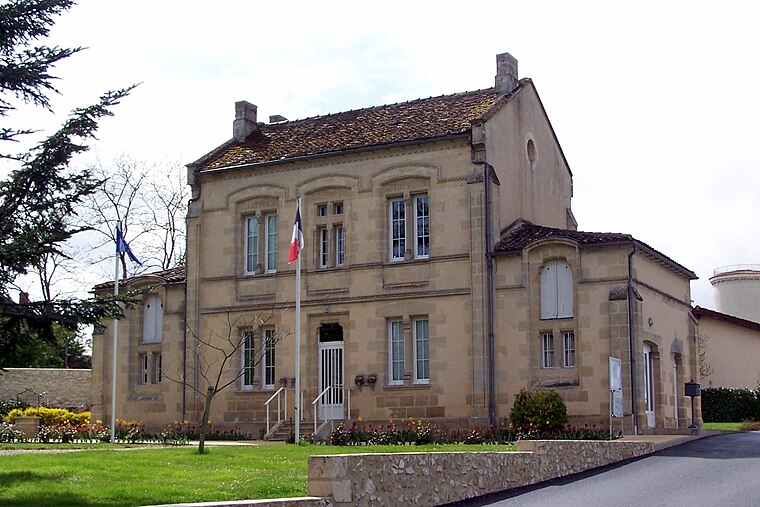
Photo: Henrysalome, CC BY-SA 3.0.
Budos is a commune in the Gironde department in Nouvelle-Aquitaine in southwestern France. Budos is situated 3 km south of Les Arrougeys.
Illats
Village

Photo: Henrysalome, CC BY-SA 3.0.
Illats is a commune in the Gironde department in Nouvelle-Aquitaine in southwestern France. It was founded in the eleventh century. Illats is part of the Graves wine-growing region. The Chateau Hillot winery is located here. Illats is situated 4½ km north of Les Arrougeys.
Sauternes
Village

Photo: Henrysalome, CC BY-SA 4.0.
Sauternes is a commune in the Gironde department in Nouvelle-Aquitaine in southwestern France. It is also a wine region within the Graves portion of Bordeaux that produces sweet white dessert wines, named "Sauternes" after the commune, as well as some dry white wine. Sauternes is situated 5 km southeast of Les Arrougeys.
Les Arrougeys
- Type: Hamlet
- Category: locality
- Location: Landiras, Arrondissement of Langon, Gironde, Nouvelle-Aquitaine, France, Europe
- View on OpenStreetMap
Latitude
44.56101° or 44° 33′ 40″ northLongitude
-0.39068° or 0° 23′ 27″ westOpen location code
8CPXHJ65+CPOpenStreetMap ID
node 682014628OpenStreetMap feature
place=hamlet
This page is based on OpenStreetMap, Wikidata, and Wikimedia Commons.
We’d love your help improving our open data sources. Thank you for contributing.
Satellite Map
Discover Les Arrougeys from above in high-definition satellite imagery.
Localities in the Area
Explore places such as La Couleyre and Le Carpoula.
Notable Places Nearby
Highlights include Pinguet and Place de l’Église.
Gironde: Must-Visit Destinations
Delve into Bordeaux, Arcachon, Saint-Émilion, and Soulac-sur-Mer.
Curious Hamlets to Discover
Uncover intriguing hamlets from every corner of the globe.
About Mapcarta. Data © OpenStreetMap contributors and available under the Open Database License". Text is available under the CC BY-SA 4.0 license, except for photos, directions, and the map. Photo: JLPC, CC BY-SA 3.0.