Laney’s Variety
Laney’s Variety is a gas station in Town of Spencer, Worcester, Massachusetts. Laney’s Variety is situated nearby to David Prouty High School, as well as near the peak Prouty Hill.| Tap on a place to explore it |
Places of Interest Nearby
Highlights include David Prouty High School.
David Prouty High School
School
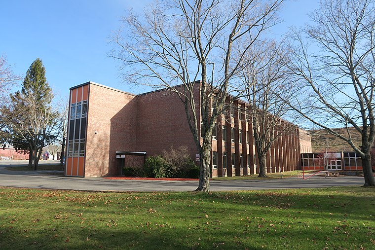
Photo: Faolin42, CC BY-SA 4.0.
David Prouty High School is a public high school located in Spencer, Massachusetts, United States. It serves the towns of Spencer and East Brookfield. In 2024, it was ranked as the #300 best high school in Massachusetts by the U.S. David Prouty High School is situated 2,000 feet southwest of Laney’s Variety.
Places in the Area
Nearby places include Spencer and Leicester.
Spencer
Town
 Spencer is a town in Worcester County, Massachusetts, United States. The population was 11,992 at the 2020 census. For geographic and demographic information on the census-designated place Spencer, please see the article Spencer, Massachusetts.
Leicester
Town

Photo: Pvmoutside, Public domain.
Leicester is a town in Worcester County, Massachusetts, United States. The population was 11,087 at the 2020 United States census. Leicester is situated 3½ miles east of Laney’s Variety.
East Brookfield
Town

Photo: LymanSchool, CC BY-SA 3.0.
East Brookfield is a town in Worcester County, Massachusetts, United States. The population was 2,224 at the 2020 United States Census. The census-designated place of East Brookfield is located in the town. East Brookfield is situated 4½ miles southwest of Laney’s Variety.
Laney’s Variety
- Type: Gas station
- Category: transportation
- Location: Town of Spencer, Worcester, Massachusetts, New England, United States, North America
- View on OpenStreetMap
Latitude
42.2524° or 42° 15′ 9″ northLongitude
-71.97264° or 71° 58′ 22″ westBrand
SunocoOpen location code
87JC722G+XWOpenStreetMap ID
node 6855571866OpenStreetMap feature
amenity=fuel
This page is based on OpenStreetMap, Wikidata, and Wikimedia Commons.
We’d love your help improving our open data sources. Thank you for contributing.
Satellite Map
Discover Laney’s Variety from above in high-definition satellite imagery.
Notable Places Nearby
Highlights include Prouty Hill and Lake Whittemore.
Nearby Places
Explore places such as Sibley Trail Parking and WAYW-FM (Worcester).
Massachusetts: Must-Visit Destinations
Delve into Boston, Cambridge, Springfield, and Downtown Boston.
Curious Gas Stations to Discover
Uncover intriguing gas stations from every corner of the globe.
About Mapcarta. Data © OpenStreetMap contributors and available under the Open Database License". Text is available under the CC BY-SA 4.0 license, except for photos, directions, and the map. Photo: papadunes, CC BY-SA 3.0.