Ravine Park Map
Ravine Park Map is in Ward 1, Ottawa, Ontario. Ravine Park Map is situated nearby to Cardinal Farm Park, as well as near the pitch Ball Diamond (Minors).| Tap on a place to explore it |
Places of Interest Nearby
Highlights include Our Lady Of Wisdom School and Place d’Orléans.
Our Lady Of Wisdom School
School
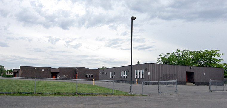
Photo: Php man, CC BY-SA 3.0.
Our Lady of Wisdom Catholic School is a Canadian elementary school in the Orleans area of Ottawa, Ontario. Our Lady Of Wisdom School is situated 570 metres northeast of Ravine Park Map.
Place d’Orléans
Shopping center

Photo: SimonP, CC BY-SA 3.0.
Place d'Orléans is a shopping mall in Orléans suburb of Ottawa, Ontario, Canada. The property is about 740,000 sq ft and has approximately 132 stores and services. Place d’Orléans is situated 2 km northwest of Ravine Park Map.
Sir Wilfrid Laurier Secondary School
School
Sir Wilfrid Laurier Secondary School is a public high school located in the Fallingbrook neighbourhood within the suburb of Orléans in Ottawa, Ontario, Canada. Sir Wilfrid Laurier Secondary School is situated 1½ km northeast of Ravine Park Map.
Places in the Area
Nearby places include Orleans and Notting Gate.
Orleans
Suburb

Photo: Alaney2k, CC BY-SA 3.0.
Orleans is a community in the east end of Ottawa, Ontario, Canada, along the Ottawa River about 16 km from Downtown Ottawa. In the Canada 2021 Census the population was 125,937.
Notting Gate
Neighborhood
Notting Gate is a neighbourhood located in Cumberland Ward, in the suburb of Orleans in Ottawa, Ontario, Canada. Located south of Innes Road, east of Portobello Boulevard, west of Trim Road, and north of Brian Coburn Boulevard. Notting Gate is situated 3½ km east of Ravine Park Map.
Notre-Dame-des-Champs
Hamlet
Notre-Dame-des-Champs is a rural community on the northern edge of Mer Bleue in Ottawa, Ontario, Canada at the intersection of Navan Road and Mer Bleue Road. Notre-Dame-des-Champs is situated 4½ km south of Ravine Park Map.
Ravine Park Map
- Type: Map
- Categories: information and tourism
- Location: Ward 1, Ottawa, Ontario, Canada, North America
- View on OpenStreetMap
Latitude
45.46336° or 45° 27′ 48″ northLongitude
-75.50504° or 75° 30′ 18″ westOpen location code
87Q6FF7V+8XOpenStreetMap ID
node 6913597988OpenStreetMap feature
tourism=information
This page is based on OpenStreetMap, Wikidata, and Wikimedia Commons.
We’d love your help improving our open data sources. Thank you for contributing.
Satellite Map
Discover Ravine Park Map from above in high-definition satellite imagery.
Places with the Same Name
Discover other places named “Ravine Park Map”.
Notable Places Nearby
Highlights include Cardinal Farm Park and Ball Diamond (Minors).
Nearby Places
Explore places such as Ravine Park Map and St Georges / Marcoux.
Ontario: Must-Visit Destinations
Delve into Toronto, Ottawa, Hamilton, and London.
Curious Places to Discover
Uncover intriguing places from every corner of the globe.
About Mapcarta. Data © OpenStreetMap contributors and available under the Open Database License". Text is available under the CC BY-SA 4.0 license, except for photos, directions, and the map. Photo: Wikimedia, CC BY-SA 2.0.